Coalinga in Fresno County, California — The American West (Pacific Coastal)
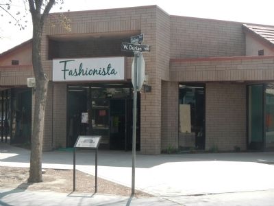
The Rockwell Building
Built in 1904 – Destroyed by earthquake in 1983
Erected by Coalinga Lions Club.
Topics. This historical marker is listed in these topic lists: Industry & Commerce • Notable Buildings. A significant historical year for this entry is 1983.
Location. 36° 8.418′ N, 120° 21.681′ W. Marker is in Coalinga, California, in Fresno County. Marker is on Coalinga Plaza (North 5th Street) near West Durian Avenue, on the left when traveling north. Touch for map. Marker is at or near this postal address: 299 Coalinga Plaza, Coalinga CA 93210, United States of America. Touch for directions.
Other nearby markers. At least 8 other markers are within walking distance of this marker. Pleasant Valley Hotel (within shouting distance of this marker); Row of Store Buildings Destroyed By Earthquake in 1983 (within shouting distance of this marker); First National Bank of Coalinga (within shouting distance of this marker); 5th Street, Coalinga 1912 (within shouting distance of this marker); Webb Building (about 300 feet away, measured in a direct line); Amy Building (about 300 feet away); The Earthquake of 1983 (about 300 feet away); The Bertrich Block (about 400 feet away). Touch for a list and map of all markers in Coalinga.
Credits. This page was last revised on June 16, 2016. It was originally submitted on March 29, 2013, by Barry Swackhamer of Brentwood, California. This page has been viewed 480 times since then and 14 times this year. Photos: 1, 2. submitted on March 29, 2013, by Barry Swackhamer of Brentwood, California. • Syd Whittle was the editor who published this page.

