Coalinga in Fresno County, California — The American West (Pacific Coastal)
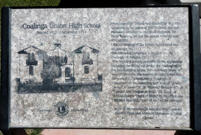
Coalinga Union High School
Erected 1910 – Dismantled 1933
Photographed by Barry Swackhamer, March 22, 2013
1. Coalinga Union High School Marker
Official Opening of the Union High School was on January 19, 1911.
The following paragraph is taken from the Coalinga Oil Record, 1911.
“The building is equipped with all the appliances including the lifting top desks, the reading table, the bookkeeping tables, the chemistry tables in the way of furniture; the heating apparatus and fan, the statuary; Thorwaldsen’s “Triumph of Alexander” in the assembly hall; bust of “Julius Caesar" in room “B”, of “Homer” in room “C”, of “Agassiz” and Wagner in room “D”, copy of Holman Hunt’s “Flight of Night” in the office and Chaplin’s beautiful “Joan of Arc” in the hallway.”
Style of architecture is adapted from Spanish Mission type and answers demands of local climate.
Erected by Coalinga Lions Club.
Topics. This historical marker is listed in these topic lists:
this page online
Location. 36° 8.646′ N, 120° 21.799′ W. Marker is in Coalinga, California, in Fresno County. It is at the intersection of Sunset Avenue and Van Ness Street, on the right when traveling north on Sunset Avenue. The marker is located on the Sunset Avenue side of Coalinga Union High School building. Touch for map. Marker is at or near this postal address: 750 Van Ness Street, Coalinga CA 93210, United States of America. Touch for directions.

Regionally, this marker is in the San Joaquin Valley, specifically in the Central Valley, and in the Sierra Nevada. It is also on the American Pacific Coast. Globally, it is in North America, on the Ring of Fire, on the Pacific Rim, in the Western Hemisphere, in the Western World, and in the Anglosphere. Historically, it finds itself in what was once New Spain and also Mexico’s Alta California.
Other nearby markers. At least 8 other markers are within walking distance of this marker: Motte Fountain (within shouting distance of this marker); Grammar School (about 700 feet away, measured in a direct line);
Photographed by Barry Swackhamer, March 22, 2013
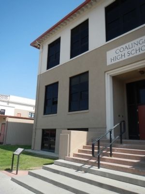
2. Coalinga Union High School Marker
Photographed by Barry Swackhamer, March 22, 2013
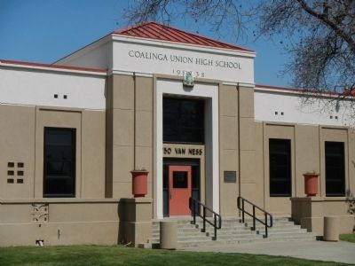
3. Coalinga Union High School today
Credits. This page was last revised on June 16, 2016. It was originally submitted on March 31, 2013, by Barry Swackhamer of Brentwood, California. This page has been viewed 1,133 times since then and 27 times this year. Photos: 1, 2, 3. submitted on March 31, 2013, by Barry Swackhamer of Brentwood, California. • Syd Whittle was the editor who published this page.
