Atoka in Atoka County, Oklahoma — The American South (West South Central)
Historic Butterfield Trail in Indian Territory
1857-1861
Inscription.
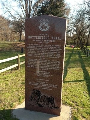
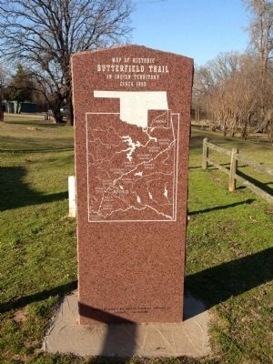
On September 16, 1857, the John Butterfield Company received a Federal contract to transport mail from Missouri to San Francisco in under 25 days. Semiweekly service began a year later. Twelve relay stations lined the Butterfield Trail in Indian Territory. Three (Waddle's Station, Geary's Station and Boggy Depot) were in present-day Atoka County. (See Back)
The Butterfield Trail permitted early trans-continental communication and was vital to settling the West. Service was halted by the Civil War (1861-1865). Afterward, railroads transported mail more quickly, rendering the Butterfield Trail obsolete.
Commemorating the 150th Anniversary of the Butterfield Trail in Indian Territory
Erected 2007 by The Lake Atoka Reservation Association, The Oklahoma City Water Utilities Trust, The City of Atoka, The City of Oklahoma City.
Topics and series. This historical marker is listed in these topic lists: Communications • Industry & Commerce • Roads & Vehicles • Settlements & Settlers. In addition, it is included in the Butterfield Overland Mail series list. A significant historical date for this entry is September 16, 1857.
Location. 34° 23.944′ N, 96° 7.005′ W. Marker is in Atoka, Oklahoma, in Atoka County. Marker can be reached from North Mississippi Avenue (U.S. 69) 0.8 miles north of West Liberty Road (U.S. 75), on the right when traveling north. Marker is located on the Butterfield Trail within the Confederate Memorial Park north of Atoka. Touch for map. Marker is in this post office area: Atoka OK 74525, United States of America. Touch for directions.
Other nearby markers. At least 8 other markers are within 12 miles of this marker, measured as the crow flies. Middle Boggy Battle (a few steps from this marker); Cornerstone from [Atoka] County Courthouse (approx. 1.1 miles away); War Memorial (approx. 1.1 miles away); 45th Infantry Division Memorial Highway (approx. 1.1 miles away); Vietnam War Memorial (approx. 1.1 miles away); Captain Atoka (approx. 1.1 miles away); Stringtown Shootout (approx. 5.4 miles away); Courthouse (approx. 11.2 miles away). Touch for a list and map of all markers in Atoka.
Credits. This page was last revised on June 16, 2016. It was originally submitted on April 1, 2013, by Michael Manning of Woodlawn, Tennessee. This page has been viewed 1,039 times since then and 52 times this year. Photos: 1, 2. submitted on April 1, 2013, by Michael Manning of Woodlawn, Tennessee. • Bernard Fisher was the editor who published this page.

