Highland in Lake County, Indiana — The American Midwest (Great Lakes)
Dutch in the Calumet Region
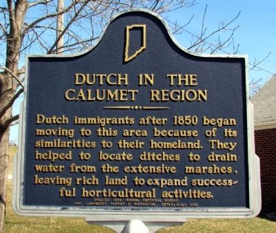
Photographed by Duane Hall, April 3, 2013
1. Dutch in the Calumet Region Marker
Erected 1992 by Indiana Historical Bureau and Lamprecht Florist & Greenhouse. (Marker Number 45.1992.1.)
Topics and series. This historical marker is listed in these topic lists: Horticulture & Forestry • Settlements & Settlers. In addition, it is included in the Indiana Historical Bureau Markers series list. A significant historical year for this entry is 1850.
Location. 41° 33.03′ N, 87° 26.228′ W. Marker is in Highland, Indiana, in Lake County. It is on Kleinman Rd 0.1 miles south of Ridge Rd (Business U.S. 6), on the left when traveling south. Touch for map. Marker is at or near this postal address: 8941 Kleinman Rd, Highland IN 46322, United States of America. Touch for directions.

Regionally, this marker is in Northwest Indiana and in the Calumet Region. It is also in the American Midwest and in the Corn Belt. Globally, it is in North America, on the Great Lakes,
this page online
Other nearby markers. At least 8 other markers are within 3 miles of this marker, measured as the crow flies: CommuniTree Tree Planting (approx. 1.7 miles away); Metasequoia (Dawn Redwood) (approx. 1.8 miles away); The Hoosier Flag Lady (approx. 1.8 miles away); Highway of Flags Servicemen's Memorial (approx. 1.8 miles away); Ray Nichels (approx. 1.8 miles away); Hammond Optimist Club (approx. 1.9 miles away); Dune Wall (approx. 1.9 miles away); Elgin, Joliet, & Eastern Railway Interlocking Tower (approx. 2.1 miles away). Touch for a list and map of all markers in Highland.
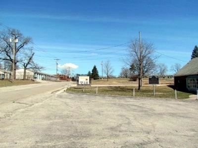
Photographed by Duane Hall, April 3, 2013
2. Dutch in the Calumet Region Marker
Credits. This page was last revised on June 16, 2016. It was originally submitted on April 5, 2013, by Duane Hall of Abilene, Texas. This page has been viewed 842 times since then and 29 times this year. Photos: 1, 2. submitted on April 5, 2013, by Duane Hall of Abilene, Texas. • Bill Pfingsten was the editor who published this page.
