Bradley in Monterey County, California — The American West (Pacific Coastal)
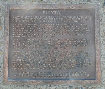
Pleyto
As early as 1796, the area was known as Pleito or El Pleito. Pleito, a Spanish legal term meaning ‘litigation’ or ‘dispute’, may have been applied due to a dispute between the San Miguel and San Antonio Missions over property rights. Another theory is that the Indian Rancheria of Assil, located near the old Pleyto Bridge, was a meeting place where Indians disagreements or lawsuits were settled.
On July 18, 1845, the land was granted to Jose Antonio Chavez as Rancho San Bartolome. Twelve years later the Rancho, by then known as Pleyto, was purchased by W.S. Johnson. In 1868 William Pinkerton, Sr. bought 13,100 acres of the ranch. It was Pinkerton who laid out the town.
A post office was opened on December 14, 1870 under the name ‘Pleito’. The coast stage line, which maintained stables here, listed the stop as ‘Plato Ranch’ per its 1871 time table. By 1884 the post office name was changed to ‘Pleyto’. Despite the changeable name, the town boasted a store, hotel, blacksmith shop, dance hall and school. The post office closed for the last time on February 14, 1929, and the town receded into memory. By 1964, when the San Antonio Dam was completed, few vestiges of the pioneer settlement remained.
Erected 1998 by E Clampus Vitus, Monterey Viejo Chapter No. 1846.
Topics and series. This historical marker is listed in this topic list: Settlements & Settlers. In addition, it is included in the E Clampus Vitus, and the Postal Mail and Philately series lists. A significant historical month for this entry is February 1717.
Location. 35° 52.364′ N, 120° 59.445′ W. Marker is in Bradley, California, in Monterey County. Marker can be reached from New Pleyto Road, on the left when traveling south. Touch for map. Marker is in this post office area: Bradley CA 93426, United States of America. Touch for directions.
Other nearby markers. At least 5 other markers are within 16 miles of this marker, measured as the crow flies. Lockwood (approx. 6.8 miles away); Jolon (approx. 12.3 miles away); Dutton Hotel (approx. 12˝ miles away); Jose Mario Gil Adobe (approx. 12.6 miles away); Lincoln-Adelaida School (approx. 16 miles away).
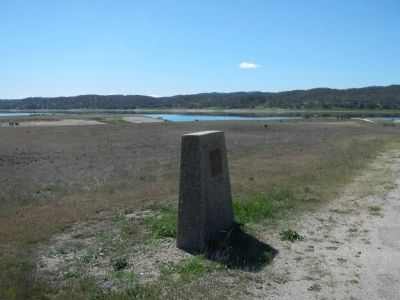
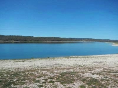
More about this marker. This marker is in San Antonio Reservoir Recreation Area on the east side of the lake.
Credits. This page was last revised on June 16, 2016. It was originally submitted on April 14, 2013, by Barry Swackhamer of Brentwood, California. This page has been viewed 1,238 times since then and 101 times this year. Photos: 1, 2, 3. submitted on April 14, 2013, by Barry Swackhamer of Brentwood, California. • Syd Whittle was the editor who published this page.


