Bivalve in Cumberland County, New Jersey — The American Northeast (Mid-Atlantic)
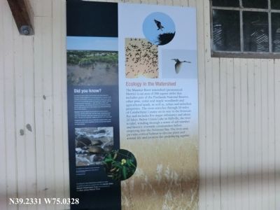
Ecology in the Watershed
Maurice River Watershed
Did you know?
The Maurice River system and the fresh and tidal wetlands it supports provide habitat for a diverse population of species, both migratory and resident. As part of the Atlantic Flyway, the river is part of the internationally significant region that supports millions of migrating birds each year. In 1993, the Maurice River and several tributaries, including the Menantico and Muskee Creeks and the Manumuskin River, were added to the National Wild and Scenic River System.
Discover:
Natural habitat for rare plant and animal species, including sensitive joint vetch, the bald eagle, striped bass and other fish shorebirds, shortnose sturgeon and wild rice or wild oats—the sora rail “mud hen” feeds on wild rice on its way south.
Phragmites, which grow up to 13 feet and spread 30 feet a year, choke out native marsh vegetation and the animals that depend on native grasses.
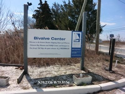
Erected by Bayshore Discovery Project.
Topics. This historical marker is listed in these topic lists: Industry & Commerce • Waterways & Vessels. A significant historical year for this entry is 1993.
Location. 39° 13.986′ N, 75° 1.968′ W. Marker is in Bivalve, New Jersey, in Cumberland County. Marker is on High Street. Touch for map. Marker is at or near this postal address: 2800 High Street, Port Norris NJ 08349, United States of America. Touch for directions.
Other nearby markers. At least 8 other markers are within 3 miles of this marker, measured as the crow flies. Bivalve Oyster Shipping Sheds (here, next to this marker); The Schooner AJ Meerwald (here, next to this marker); Delaware Bay and River (here, next to this marker); Steps to Harvest Oysters and Bring to Market (within shouting distance of this marker); a different marker also named Steps to Harvest Oysters and Bring to Market (within shouting distance of this marker); Maurice River (within shouting distance of this marker); A Guiding Light (approx. 2.6 miles away); All Shapes, Sizes and Materials (approx. 2.6 miles away). Touch for a list and map of all markers in Bivalve.
Credits. This page was last revised on June 16, 2016. It was originally submitted on April 13, 2013, by Don Morfe of Baltimore, Maryland. This page has been viewed 343 times since then and 12 times this year. Last updated on April 17, 2013. Photos: 1, 2. submitted on April 13, 2013, by Don Morfe of Baltimore, Maryland. • Bill Pfingsten was the editor who published this page.

