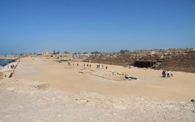
Caesarea, Haifa District, Israel — West Asia (the Levant in the Middle East)
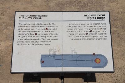
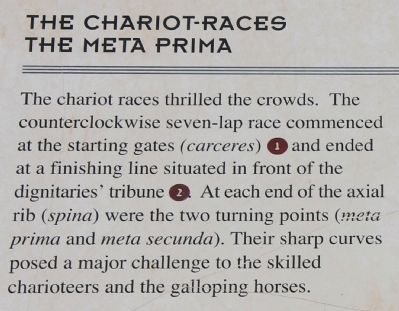
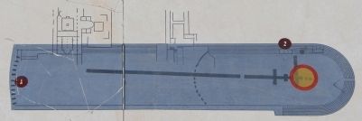
The Chariot-Races
The Meta Prima
Topics. This historical marker is listed in these topic lists: Anthropology & Archaeology • Entertainment.
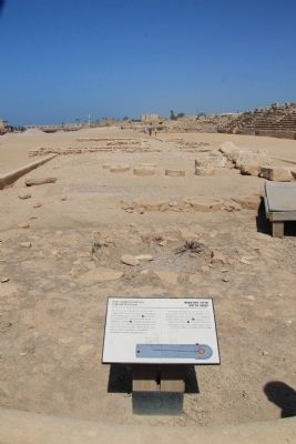
Location. 32° 29.846′ N, 34° 53.422′ E. Marker is in Caesarea, Haifa District. Marker can be reached from Kvish HaTe'atron just west of Rothschild, on the left when traveling west. This historical marker is located in the Caesarea Maritima National Park, very near to the western end of Kvish HaTe'atron Street. After traveling along the park walkway that leads from the Theater/ Archaeological Park area, to the Promontory Palace, and then to the Hippodrome, you will find this historical marker situated by the turn at the southern end of the Hippodrome. Touch for map. Touch for directions.
Other nearby markers. At least 8 other markers are within walking distance of this marker. History of the Compound (a few steps from this marker); King Herod's Hippodrome (within shouting distance of this marker); I Appeal Unto Caesar (within shouting distance of this marker); Power and Control (within shouting distance of this marker); Dedicatory Inscription (within shouting distance of this marker); The Roman Well (about 90 meters away, measured in a direct line); The Lower Palace (about 90 meters away); The Promontory Palace (about 90 meters away). Touch for a list and map of all markers in Caesarea.
Related markers. Click here for a list of markers that are related to this marker. To better understand the relationship, study each marker in the order shown.
Also see . . .
1. Caesarea Maritima. This is a link to information provided by Wikipedia, the free encyclopedia. (Submitted on April 19, 2013, by Dale K. Benington of Toledo, Ohio.)
2. Caesarea. This is a link to information provided by the BibleWalks.com website. (Submitted on April 19, 2013, by Dale K. Benington of Toledo, Ohio.)
3. Hippodrome. This is a link to information provided by Wikipedia, the free encyclopedia. (Submitted on April 19, 2013, by Dale K. Benington of Toledo, Ohio.)
4. Roman Circus, Circus Maximus, Hippodrome. This is a link to information provided by the CrystaLinks website. (Submitted on April 19, 2013, by Dale K. Benington of Toledo, Ohio.)
Photographed By Dale K. Benington, March 9, 2013
6. The Chariot-Races
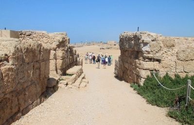
View of the pathway that allows visitors to enter into the hippodrome area from the south, and stand where the chariot-races were held. The featured historical marker is situated just beyond the group of people seen in the picture.
Credits. This page was last revised on May 16, 2018. It was originally submitted on April 19, 2013, by Dale K. Benington of Toledo, Ohio. This page has been viewed 854 times since then and 39 times this year. Photos: 1, 2, 3, 4, 5, 6. submitted on April 20, 2013, by Dale K. Benington of Toledo, Ohio.
