Near Megiddo, Haifa District, Israel — West Asia (the Levant in the Middle East)
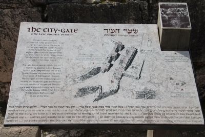
The City-Gate
(The Late Bronze Period)
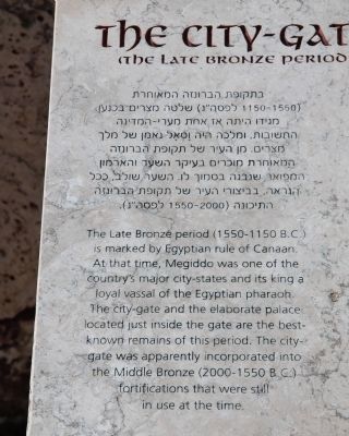
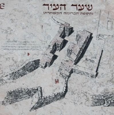
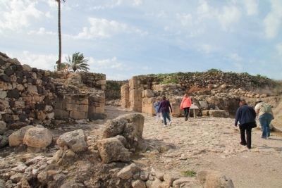
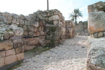
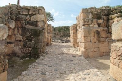
The Late Bronze period (1550-1150 B.C.) is marked by Egyptian rule of Canaan. At that time, Megiddo was one of the country's major city-states and its king a loyal vassal of the Egyptian pharaoh. The city-gate and the elaborate palace located just inside the are the best-known remains of this period. The city-gate was apparently incorporated into the Middle Bronze (2000-1550 B.C.) fortifications that were still in use at the time.
[Text across the Bottom of the Marker]:
"Say to the king, my Lord and my sun: message of the Biriowa, the Loyal servant of the king. (...) Lab'ayu {king of shechem} has waged war against me. (...) and we are unable to go out of the city-gate (...) so may the king give a garrison of 100 men to guard his city lest Lab'ayu seize it (...) he seeks simply the seizure of 'magidda" (El-Amarna archive, extract of a 14th c. B.C. Letter from the King of Megiddo to the Egyptian pharaoh)
Topics and series. This historical marker is listed in these topic lists: Anthropology & Archaeology • Forts and Castles • Settlements & Settlers. In addition, it is included in the Tel Megiddo series list.
Location. 32° 35.176′ N, 35° 11.048′ E. Marker is near Megiddo, Haifa District. Marker can be reached from National Route 66 just north of National Route 65, on the left when traveling north. This historical marker is located in the Megiddo National Park. The park is located between the Megiddo and Yokne‘am junctions (road no. 66), about 2 km west of the Megiddo junction. The historical marker is situated beyond the visitor center and parking lot, along the footpath that takes visitors to the archaeological park, and it is the first marker that you encounter at the top of Tel Megiddo (as you approach the ancient city gate). Touch for map. Touch for directions.
Other nearby markers. At least 8 other markers are within walking distance of this marker. A different marker also named The City-Gate (a few steps from this marker); The Northern Stables (about 90 meters away, measured in a direct line); The Northern Palace (about 120 meters away); Schumaker's Excavations (about 120 meters away); From Megiddo to Armageddon (about 120 meters away); Tel Megiddo National Park (about 120 meters away); A Public Grain Silo (about 150 meters away); The Sacred Area (about 150 meters away). Touch for a list and map of all markers in Megiddo.
Related markers. Click here for a list of markers that are related to this marker. To better understand the relationship, study each marker in the order shown.
Also see . . .
1. Tel Megiddo. This is a link to information provided by Wikipedia, the
free encyclopedia. (Submitted on April 27, 2013, by Dale K. Benington of Toledo, Ohio.)
2. The Megiddo Expedition. This is a link to information provided by The Megiddo Expedition Website. (Submitted on April 28, 2013, by Dale K. Benington of Toledo, Ohio.)
3. Tell Megiddo. This is a link to information provided by the BibleWalks.com website. (Submitted on April 28, 2013, by Dale K. Benington of Toledo, Ohio.)
Credits. This page was last revised on June 16, 2023. It was originally submitted on April 27, 2013, by Dale K. Benington of Toledo, Ohio. This page has been viewed 789 times since then and 48 times this year. Photos: 1, 2. submitted on April 27, 2013, by Dale K. Benington of Toledo, Ohio. 3, 4, 5, 6, 7, 8. submitted on April 28, 2013, by Dale K. Benington of Toledo, Ohio.
