Coloma in Berrien County, Michigan — The American Midwest (Great Lakes)
Baker Park
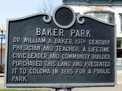
Photographed by Duane Hall, April 26, 2013
1. Baker Park Marker
Topics. This historical marker is listed in this topic list: Charity & Public Work. A significant historical year for this entry is 1885.
Location. 42° 11.196′ N, 86° 18.369′ W. Marker is in Coloma, Michigan, in Berrien County. It is at the intersection of North Paw Paw Street and East Center Street, on the right when traveling north on North Paw Paw Street. Marker is located in Baker Park at the northeast corner of the intersection across from city hall. Touch for map. Marker is in this post office area: Coloma MI 49038, United States of America. Touch for directions.

Regionally, this marker is in Southwest Michigan and specifically in one of the Lake Michigan Shore counties. It is also in the American Midwest. Globally, it is in North America, on the Great Lakes, in the Western Hemisphere, in the Western World, and in the Anglosphere. Historically, it finds itself in what was once the Viceroyalty of New France and also the Northwest Territory.
this page online
Other nearby markers. At least 8 other markers are within walking distance of this marker: Coloma World War II Memorial (here, next to this marker); Coloma Desert Shield/Desert Storm Memorial (here, next to this marker); Coloma Korean Veterans Memorial (a few steps from this marker); Coloma World War I Memorial (within shouting distance of this marker); Coloma Vietnam War Memorial (within shouting distance of this marker); Coloma Veterans of Foreign Wars Monument (within shouting distance of this marker); Coloma Interurban Station (about 800 feet away, measured in a direct line); Gilson Park (approx. 0.4 miles away). Touch for a list and map of all markers in Coloma.
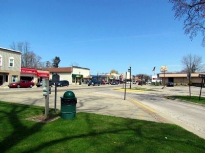
Photographed by Duane Hall, April 26, 2013
2. Baker Park Marker
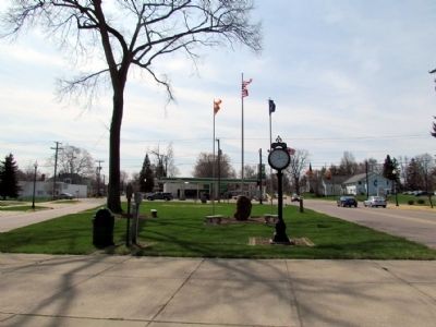
Photographed by Duane Hall, April 26, 2013
3. Baker Park
Credits. This page was last revised on June 16, 2016. It was originally submitted on April 29, 2013, by Duane Hall of Abilene, Texas. This page has been viewed 671 times since then and 29 times this year. Photos: 1, 2, 3. submitted on April 29, 2013, by Duane Hall of Abilene, Texas. • Bernard Fisher was the editor who published this page.
