Almaden in San Jose in Santa Clara County, California — The American West (Pacific Coastal)
Incline Tramway

Photographed by Barry Swackhamer, April 23, 2013
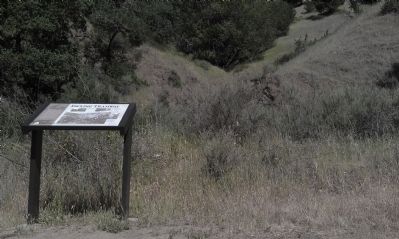
1. Incline Tramway Marker
Transportation of ore to the furnaces was slow and expensive by horse and wagon, and production and demand had increased greatly.
This gravity-aided tram was used to move thousands of tons of cinnabar ore across this steep terrain from shafts and sorting sheds to the furnaces.
Loaded ore cars travelling (sic) down hill helped pull empty cars back up to the top with cables. The rail line with three steep inclines had almost three miles of track and was used for some 40 years.
photo captions, clockwise from the top left:
The hillside in front of you is where ore cars loaded with cinnabar traveled downhill on their way to the furnaces.
Over 100 rail cars, each carrying two tons of ore made the round-trip across Deep Gulch Creek on this graceful bridge at the bottom of the incline.
Mine workers, not motors, controlled the rail braking system. Heavier ore-filled cars at the top of the tramway were connected via cables to empty cars at the bottom. The weight of the empty car being
this page online
At the upper left is the rail tramway coming down from the Cora Blanca and the Main Tunnel sorting shed. At the very top of the photo is Spanish Camp and the bottom of the photo was called China Dump.
Erected 2013 by Santa Clara County Parks.
Topics. This historical marker is listed in these topic lists: Industry & Commerce • Railroads & Streetcars. A significant historical year for this entry is 1864.
Location. 37° 10.475′ N, 121° 49.673′ W. Marker is in San Jose, California, in Santa Clara County. It is in Almaden. It can be reached from Almaden Road. This marker is Almaden Quicksilver Park on the Mine Hill Trail near the Hacienda Entrance. Touch for map. Marker is at or near this postal address: 21785 Almaden Road, San Jose CA 95120, United States of America. Touch for directions.

Regionally, this marker is in California’s San Francisco Bay Area, in Silicon Valley, and on the Coast Ranges. It is also on the American Pacific Coast. Globally, it is in North America, on the Ring of Fire, in the Pacific Rim, in the Western
Photographed by Barry Swackhamer, April 23, 2013
2. Incline Tramway Marker
Other nearby markers. At least 8 other markers are within walking distance of this marker: Hacienda Mining Display (about 600 feet away, measured in a direct line); Cornish Pump (about 600 feet away); Hoeing Table and Cleaning Tank (about 600 feet away); Mercury Storage Vault (about 600 feet away); Shaker-Concentrator (about 600 feet away); D Retort and Condensing System (about 600 feet away); Gould Rotary Furnace and Condensing System (about 600 feet away); Skip Loader (about 700 feet away). Touch for a list and map of all markers in San Jose.
Credits. This page was last revised on February 13, 2026. It was originally submitted on May 2, 2013, by Barry Swackhamer of Brentwood, California. This page has been viewed 916 times since then and 34 times this year. Photos: 1, 2. submitted on May 2, 2013, by Barry Swackhamer of Brentwood, California. • Syd Whittle was the editor who published this page.
