Central San Jose in Santa Clara County, California — The American West (Pacific Coastal)
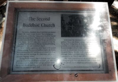
The Second Buddhist Church
In the 1930s, a gym was added next to the second church building. The present Buddhist temple, the Hondo, was constructed in 1937, and the second church building was then used for meetings, for classrooms, and for a Japanese language school.
During World War II, church facilities were closed upon the evacuation of all Japanese-Americans. After the War ended, with the help of many groups and individuals the second church building and gym were opened as a hostel for returnees in April 1945.
In the hostel, the returnees were faced with cramped quarters. Often, only blanket curtains separated families. During these trying times, the hostel provided a support system by which the people were able to receive assistance. Returnees helped each other find new homes and new jobs in order to rebuild their lives which were so tragically disrupted. During this time, 1,400 people were served. Although original provisions ended, the hostel was continued by the church until 1955.
After many years of service, the second church building and gym were torn down in order to make way for the present Annex which was dedicated in 1958.
*some oral histories differ on the first location of the original church.
Topics. This historical marker is listed in these topic lists: Asian Americans • Churches & Religion. A significant historical month for this entry is April 1945.
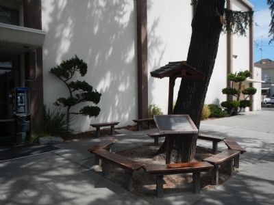
Location. 37° 20.982′ N, 121° 53.677′ W. Marker is in San Jose, California, in Santa Clara County. It is in Central San Jose. Marker is on North 5th Street just north of Jackson Street, on the right when traveling north. Touch for map. Marker is at or near this postal address: 640 North 5th Street, San Jose CA 95112, United States of America. Touch for directions.
Other nearby markers. At least 8 other markers are within walking distance of this marker. San Jose Buddhist Church Betsuin (within shouting distance of this marker); Taihei Hotel (within shouting distance of this marker); Mr. Peckham (within shouting distance of this marker); Ken Ying Low (about 300 feet away, measured in a direct line); Nihonmachi (about 300 feet away); Kawakami Building (about 300 feet away); Old Japantown Garage (about 300 feet away); Dobashi Market (about 300 feet away). Touch for a list and map of all markers in San Jose.
Credits. This page was last revised on February 7, 2023. It was originally submitted on May 2, 2013, by Barry Swackhamer of Brentwood, California. This page has been viewed 562 times since then and 16 times this year. Photos: 1, 2. submitted on May 2, 2013, by Barry Swackhamer of Brentwood, California. • Syd Whittle was the editor who published this page.

