Maumee in Lucas County, Ohio — The American Midwest (Great Lakes)
41st Regiment of Foot - War of 1812 / Private Patrick Russell
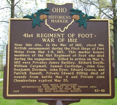
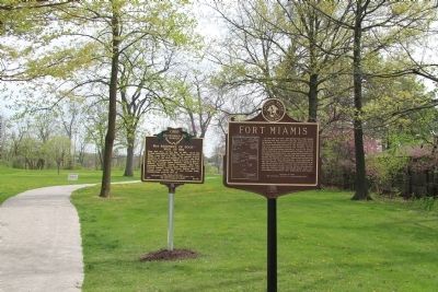
[Front Side of Marker]: 41st Regiment of Foot - War of 1812
Near this site, in the War of 1812, stood the British encampment during the First Siege of Fort Meigs from May 1-9, 1813. This marker honors members of the 41st Regiment of Foot who died during the engagement. Killed in action on May 5, 1813 were Privates James Barkley, Richard Booth, William Carpmail, Samuel Cartledge, John Cox, Benjamin Dorman, John Dyer, Edward Graves, and Patrick Russell. Private Edward Billing died of wounds from battle May 6 and Private John Chamberlane expired May 20.
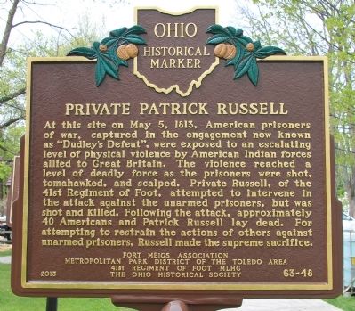
[Reverse Side of Marker]: Private Patrick Russell
At this site on May 5, 1813, American prisoners of war, captured in the engagement now known as "Dudley's Defeat", were exposed to an escalating level of physical violence by American Indian forces allied to Great Britain. The violence reached a level of deadly force as the prisoners were shot, tomahawked, and scalped. Private Russell, of the 41st Regiment of Foot, attempted to intervene in the attack against the unarmed prisoners, but was shot and killed. Following the attack, approximately 40 Americans and Patrick Russell lay dead. For attempting to restrain the actions of others against unarmed prisoners, Russell made the supreme sacrifice.
Erected 2013 by Fort Meigs Association, Metropolitan Park District of the Toledo Area, 41st Regiment of Foot M.L.H.G., The Ohio Historical Society. (Marker Number 63-48.)
Topics and series. This memorial is listed in these topic lists: Forts and Castles • Native Americans • War of 1812. In addition, it is included in the Ohio Historical Society / The Ohio History Connection series list. A significant historical month for this entry is May 1966.
Location. 41° 34.387′ N, 83° 37.611′ W. Marker is in Maumee, Ohio, in Lucas County. Memorial is at the intersection of River Road and Michigan Avenue, on the left when traveling south on River Road. This historical marker is located where Michigan Avenue. dead ends into River Road, on the river side of River Road, in a small, Lucas County MetroPark, which is situated along the west side of the Maumee River. Touch for map. Marker is at or near this postal address: 1900 River Road, Maumee OH 43537, United States of America. Touch for directions.
Other nearby markers. At least 8 other markers are within walking distance of this marker. Fallen Timbers Battlefield and Fort Miamis National Historic Site (here, next to this marker); Letters From 1794 / A Strategic Location (a few steps from this marker); The Formidable Fort Miamis (within shouting distance of this marker); A Shattered Truce (about 400 feet away, measured in a direct line); Running A Gauntlet (about 400 feet away); Old Fort, New Battle (about 400 feet away); The Great Trail (approx. ¼ mile away); Lucas County Children's Home (approx. 0.6 miles away). Touch for a list and map of all markers in Maumee.
More about this marker. The city of Maumee had created a park at the site of Fort Miamis in order to protect and preserve a significant portion of the original earthworks that made up the fortification that is discussed on this historical marker. This park became part of the Lucas County Metropark system, and was recently made a part of the National Park System.
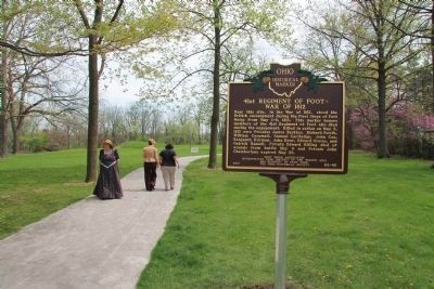
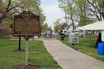
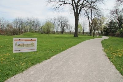
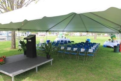
Regarding 41st Regiment of Foot - War of 1812 / Private Patrick Russell. This historical marker was erected as part of the weekend celebration of the bicentennial anniversary of the Siege of Fort Meigs, on May 3-5, 2013. In addition to this featured historical marker, I included some photos of a number of temporary displays that had been posted at the site as part of celebratory experience.
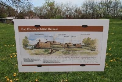
The text on the temporary "Fort Miamis, a British Outpost" marker reads as follows: "British troops constructed Fort Miamis on the banks of the Maumee River between
April and August of 1794 with the help of local Indians."
"Fort miamis featured four bastions, a river battery, barracks, officers' quarters, supply buildings and a number of shops. The formidable outpost housed over 130 British troops who manned 14 cannons protecting it from all directions. Approaching by land, hostile troops faced an abatis - a 25-foot deep trench lined with rows of 12-inch thick stakes."
Archaeological excavations in 1982 unearthed nails, wall timbers, bottle fragments, regimental buttons, and other artifacts. All that remains today are the earthwork trenches dug around the fort in 1794."
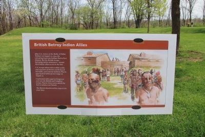
The text on the temporary "British Betray Indian Allies" marker reads as follows: "After U.S. victory at the Battle of Fallen Timbers on August 20, 1794, the retreating American Indians fled to Fort Miamis. But the British troops - betraying earlier assurances - denied their Indian allies access to the fort.
U.S. troops advanced to within a mile and a quarter of the fort on the day of the battle, and General Anthony Wayne approached within pistol-range on August 22.
Confronted with superior firepower and over 180 British and Canadian troops, Wayne chose not to attack the fort or advance on Detroit.
The British abandoned the outpost two years later."
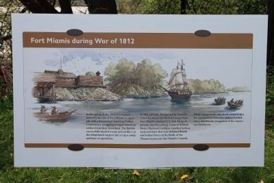
The text on the temporary "Fort Miamis during War of
1812" marker reads as follows: "In the spring of 1813, British troops returned to the site of Fort Miamis to again ally with a determined American Indian Confederacy struggling to expel American settlers from their homeland. The British successfully landed troops and artillery at the dilapidated outpost and set up a camp and base of operations.
In May and July, Indians led by Shawnee Chief Tecumseh and British troops from Fort Miamis attacked U.S. Fort Meigs in present-day Perrysburg. General William Henry Harrison's soldiers repelled both attacks and later that year defeated British and Indian forces at the Battle of the Thames in present-day Ontario, Canada."
These engagements effectively ended hopes for a permanent American Indian Confederacy and British occupation of the American Northwest.
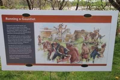
The text on the temporary "Running a Gauntlet" marker reads as follows: "Desperate to break the British and American Indian siege of Fort Meigs, General William Henry Harrison ordered 800 Kentucky Militia under Colonel William Dudley to cross the Maumee River and destroy the british batteries.
After seizing the enemy cannons on May 5, 1813, the undisciplined U.S. soldiers broke into small groups and chased the scattering Indian troops into the thick woods. British soldiers continued firing - killing and wounding many Americans.
The British
marched the prisoners to Fort Miamis and forced them to run a gauntlet of Indians. British General Henry Procter did nothing to the massacre, but upon arrival, Shawnee Chief Tecumseh stopped the ordeal and chastised his warriors.
In the end, nearly 650 Americans were killed or captured in what became known as Dudley's Defeat.
Also see . . .
1. Fort Miamis. Touring Ohio website entry (Submitted on May 5, 2013, by Dale K. Benington of Toledo, Ohio.)
2. Fort Miami (Ohio). Wikipedia entry (Submitted on May 5, 2013, by Dale K. Benington of Toledo, Ohio.)
3. Fallen Timbers Battlefield and Fort Miamis National Historic Site, Ohio. National Park Service website entry (Submitted on May 5, 2013, by Dale K. Benington of Toledo, Ohio.)
4. Siege of Fort Meigs. Wikipedia entry (Submitted on May 5, 2013, by Dale K. Benington of Toledo, Ohio.)
5. 41st (Welch) Regiment of Foot. Wikipedia entry (Submitted on May 5, 2013, by Dale K. Benington of Toledo, Ohio.)
6. The 41st Regiment of Foot Military Living History Group. Group website homepage (Submitted on May 5, 2013, by Dale K. Benington of Toledo, Ohio.)
7. 41st Regiment Deserters. RootsWeb of Ancestry website entry (Submitted on May 5, 2013, by Dale K. Benington of Toledo, Ohio.)
Credits. This page was last revised on July 10, 2022. It was originally submitted on May 5, 2013, by Dale K. Benington of Toledo, Ohio. This page has been viewed 1,400 times since then and 29 times this year. Photos: 1, 2, 3, 4, 5, 6, 7, 8, 9, 10, 11, 12, 13, 14. submitted on May 5, 2013, by Dale K. Benington of Toledo, Ohio.
