Medicine Lodge in Barber County, Kansas — The American Midwest (Upper Plains)
The First National Bank
Photographed by William Fischer, Jr., November 9, 2012
1. The First National Bank Marker
Inscription.
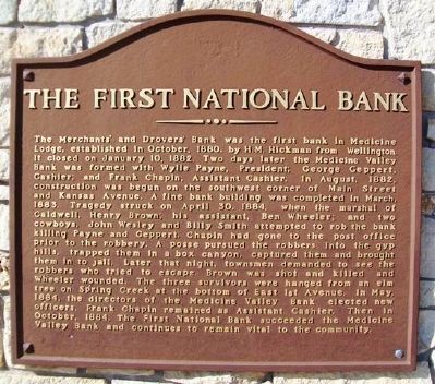
The Merchants' and Drovers' Bank was the first bank in Medicine Lodge, established in October, 1880, by H.M. Hickman from Wellington. It closed on January 10, 1882. Two days later the Medicine Valley Bank was formed with Wylie Payne, President; George Geppert, Cashier; and Frank Chapin, Assistant Cashier. In August, 1882, construction was begun on the southwest corner of Main Street and Kansas Avenue. A fine bank building was completed in March 1883. Tragedy struck on April 30, 1884, when the marshal of Caldwell, Henry Brown; his assistant, Ben Wheeler; and two cowboys, John Wesley and Billy Smith attempted to rob the bank killing Payne and Geppert. A posse pursued the robbers into the gyp hills, trapped them in a box canyon, captured them and brought them in to jail. Later that night, townsmen demanded to see the robbers who tried to escape. Brown was shot and killed and Wheeler wounded. The three survivors were hanged from an elm tree on Spring Creek at the bottom of East 1st Avenue. In May, 1884, the directors of the Medicine Valley Bank elected new officers. Frank Chapin remained as Assistant Cashier. Then in October,
Click or scan to see this page online
1884, The First National Bank succeeded the Medicine Valley Bank and continues to remain vital to the community.
Topics. This historical marker is listed in this topic list: Industry & Commerce. A significant historical month for this entry is January 1868.
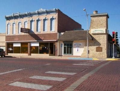
Location. 37° 16.83′ N, 98° 34.773′ W. Marker is in Medicine Lodge, Kansas, in Barber County. It is at the intersection of Main Street and Kansas Avenue, on the right when traveling south on Main Street. Touch for map. Marker is at or near this postal address: 101 South Main Street, Medicine Lodge KS 67104, United States of America. Touch for directions.
Regionally, this marker is in the American Midwest, in the Corn Belt, on the prairies, on the Great Plains, on the Southern Plains, and specifically on the High Plains. Globally, it is in North America, the Western Hemisphere, the Western World, and the Anglosphere. Historically, it finds itself in what was once New Spain, the Comanchería, the Dust Bowl, the Louisiana Purchase, and the Republic of Texas.
Other nearby markers. At least 8 other markers are within walking distance of this marker: The Grand Hotel (about 300 feet
Photographed by William Fischer, Jr., November 9, 2012
Credits. This page was last revised on August 31, 2020. It was originally submitted on May 6, 2013, by William Fischer, Jr. of Reynoldsburg, Ohio. This page has been viewed 923 times since then and 53 times this year. Photos:1, 2. submitted on May 6, 2013, by William Fischer, Jr. of Reynoldsburg, Ohio.