East Liberty in Pittsburgh in Allegheny County, Pennsylvania — The American Northeast (Mid-Atlantic)
Congregation B'nai Israel
Historic Landmark
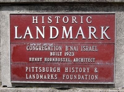
Photographed by Mike Wintermantel, May 4, 2013
1. Congregation B'nai Israel Marker
Built 1923
Henry Hornbostel, Architect
Erected by Pittsburgh History and Landmarks Foundation.
Topics and series. This historical marker is listed in these topic lists: Architecture • Religion & Religious Structures. In addition, it is included in the Pennsylvania, Pittsburgh History and Landmarks Foundation series list. A significant historical year for this entry is 1923.
Location. 40° 27.984′ N, 79° 55.745′ W. Marker is in Pittsburgh, Pennsylvania, in Allegheny County. It is in East Liberty. It can be reached from North Negley Avenue near Rippey Street, on the right when traveling south. Located at the Urban League of Pittsburgh Charter School. Touch for map. Marker is at or near this postal address: 327 North Negley Avenue, Pittsburgh PA 15206, United States of America. Touch for directions.

Regionally, this marker is in the American Northeast, in the Mid-Atlantic, in the Ohio River Valley, in Appalachia, and specifically in Northern Appalachia. Globally, it is in North America, the Western Hemisphere, the Western World, and the Anglosphere. Historically, it finds itself
this page online
Other nearby markers. At least 8 other markers are within walking distance of this marker: Peabody Memorial to Soldiers (approx. 0.3 miles away); East Liberty Presbyterian Church (approx. 0.4 miles away); Motor Square Garden (approx. half a mile away); St. Peter's Evangelical and Reformed Church (approx. half a mile away); 1st Drive-In Filling Station (approx. half a mile away); a different marker also named East Liberty Presbyterian Church (approx. half a mile away); Portal of Industry (approx. half a mile away); Suburban Catalyst (approx. half a mile away). Touch for a list and map of all markers in Pittsburgh.
Also see . . . Wikipedia article. (Submitted on May 6, 2013, by Mike Wintermantel of Pittsburgh, Pennsylvania.)
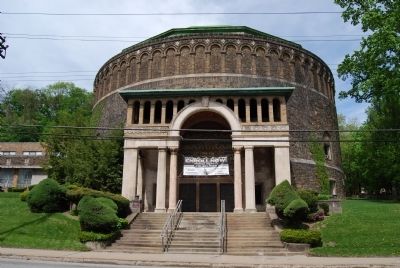
Photographed by Mike Wintermantel, May 4, 2013
2. Congregation B'nai Israel Marker
Credits. This page was last revised on February 2, 2023. It was originally submitted on May 6, 2013, by Mike Wintermantel of Pittsburgh, Pennsylvania. This page has been viewed 746 times since then and 23 times this year. Photos: 1, 2. submitted on May 6, 2013, by Mike Wintermantel of Pittsburgh, Pennsylvania.
