Near Megiddo, Haifa District, Israel — West Asia (the Levant in the Middle East)
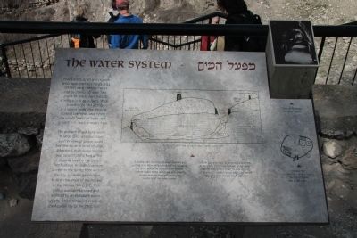
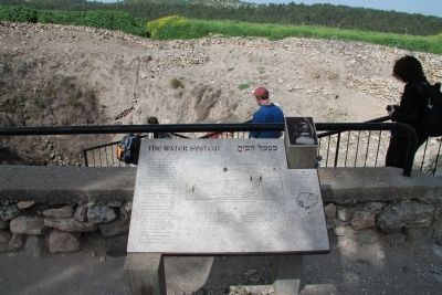
The Water System
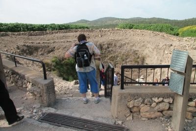
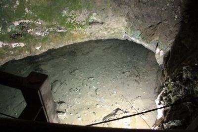
The problem of supplying water to large cities, a serious issue even in times of peace, could become acute in times of siege. Megiddo's main water source was located at the foot of the mound, beyond the city's fortifications. In order to ensure access to the spring from within the city, a hidden gallery was built on the slope of the mound in the 10th or 9th c. B.C. This gallery was later blocked and replaced by an elaborate water system, which remained in use in the Assyrian city of the 7th c. B.C.
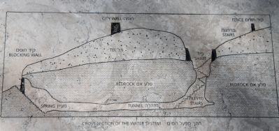
[Text from the caption, written at the bottom of the marker's featured illustration]:
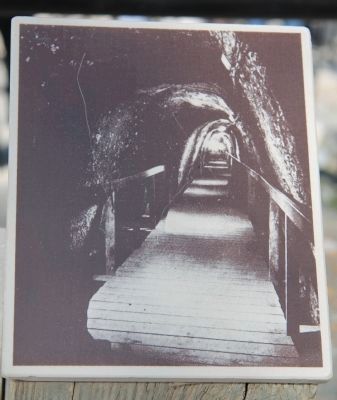
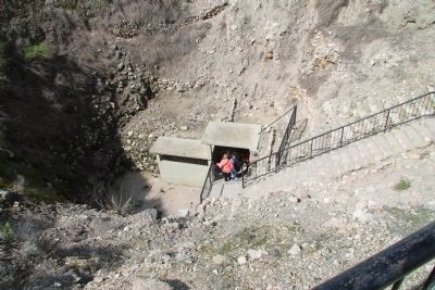
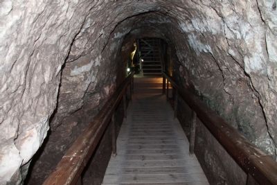
A square shaft dug through to the bedrock and ending in an 80m. long tunnel reaches the spring ca. 35m. below the surface of the mound. Outside access to the spring was concealed to prevent enemies from discovering the existence of the water system.
Topics and series. This historical marker is listed in these topic lists: Anthropology & Archaeology • Forts and Castles • Settlements & Settlers. In addition, it is included in the Tel Megiddo series list.
Location. 32° 35.092′ N, 35° 10.99′ E. Marker is near Megiddo, Haifa District. Marker can be reached from National Route 66 just north of Route 65, on the left when traveling north. This historical marker is located in the Megiddo National Park. The park is located between the Megiddo and Yokne‘am junctions (road no. 66), about 2 km west of the Megiddo junction. The historical marker is situated at the top of Tel Megiddo, near the southwestern edge of the archaeological park. Touch for map. Touch for directions.
Other nearby markers. At least 8 other markers are within walking distance of this marker. The Southern Stables (within shouting distance of this marker); A Public Grain Silo (about 120 meters away, measured in a direct line); The Southern Palace (about 120 meters away); Schumaker's Excavations (about 120 meters away); The City-Gate (about 180 meters away); a different marker also named The City-Gate (about 180 meters away); The Northern Stables (about 210 meters away); The Northern Palace (about 210 meters away). Touch for a list and map of all markers in Megiddo.
More about this marker. The "Megiddo National Park" handout/brochure has this to say about Stop 20, "The Water System" on the historic tour:
Megiddo's huge water system was hewn during the period of the Israelite kings, in order to bring water into the city without having to exit the walls. To this end, Megiddo's inhabitants dug a gigantic, 36-meter-deep shaft, from which a 70-meter-long horizontal tunnel extended to the spring, which emerged in a cave at the foot of the mound outside
the walls. The tunnel was cut on an incline so the water would flow to the bottom of the shaft and the inhabitants could draw water while standing at the top. The outer entrance to the spring was sealed with a massive stone wall, concealed with earth so that an enemy besieging the city would not discover its location.
Related markers. Click here for a list of markers that are related to this marker. To better understand the relationship, study each marker in the order shown.
Also see . . .
1. Tel Megiddo. This is a link to information provided by Wikipedia, the free encyclopedia. (Submitted on May 9, 2013, by Dale K. Benington of Toledo, Ohio.)
2. The Megiddo Expedition. This is a link to information provided by The Megiddo Expedition Website. (Submitted on May 9, 2013, by Dale K. Benington of Toledo, Ohio.)
3. Tel Megiddo. This is a link to information provided by the BibleWalks.com website. (Submitted on May 9, 2013, by Dale K. Benington of Toledo, Ohio.)
4. Megiddo - The Solomonic Chariot City. This is a link to information provided by the Jewish Virtual Library. (Submitted on May 9, 2013, by Dale K. Benington of Toledo, Ohio.)
Credits. This page was last revised on December 27, 2023. It was originally submitted on May 9, 2013, by Dale K. Benington of Toledo, Ohio. This page has been viewed 562 times since then and 11 times this year. Photos: 1, 2, 3, 4, 5, 6, 7, 8, 9. submitted on May 9, 2013, by Dale K. Benington of Toledo, Ohio.
