
Placerville in El Dorado County, California — The American West (Pacific Coastal)
The Forum Café/Union Hotel/United States Trio Hall
The Forum Café/The Blue Bell Café/The Bookery
Photographed by Barry Swackhamer, May 4, 2013
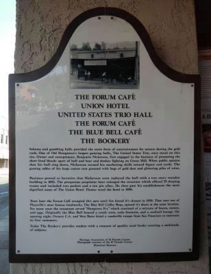
1. The Forum Café / Union Hotel / United States Trio Hall / The Forum Café / The Blue Bell Café Marker
Photo on marker courtesy of the El Dorado County Historical Museum.
Business proved so lucrative that Nickerson soon replaced the hall with a two story wooden building in 1852. The prosperous proprietor enlarged the structure which offered 75 sleeping rooms and included two parlors and a ten pin alley. He then gave his establishment the more dignified name of the Union Hotel. Flames razed the hotel in 1856.
Years later the Forum Café occupied this spot until fire forced it’s (sic) closure in 1938. That year one of Placerville’s most famous landmarks, The Blue Bell Coffee Shop, opened it’s (sic) doors at the same location.
this page online
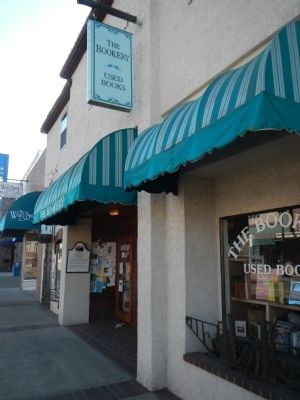
Today The Bookery provides readers with a treasure of quality used books covering a multitude of subjects.
Erected by Heritage Association of El Dorado County.
Topics. This historical marker is listed in these topic lists: Entertainment • Industry & Commerce. A significant historical year for this entry is 1852.
Location. 38° 43.699′ N, 120° 48.124′ W. Marker is in Placerville, California, in El Dorado County. It is on Main Street, on the right when traveling east. Touch for map. Marker is at or near this postal address: 326 Main Street, Placerville CA 95667, United States of America. Touch for directions.

Regionally, this marker is in California’s Sacramento Metro, in the Gold Country, in the Sierra Nevada, and in the Lake Tahoe Basin. It is also in the American Mountain West. Globally, it
Photographed by Barry Swackhamer, May 4, 2013
2. The Forum Café Marker
Other nearby markers. At least 8 other markers are within walking distance of this marker: Branch Saloon/Bingham's Jewelrey/Seligman Building/Ewing Building (within shouting distance of this marker); Hangmans Tree (within shouting distance of this marker); Randolph Jewelers (within shouting distance of this marker); Three Unfortunates Hanged (about 300 feet away, measured in a direct line); Bayles Building (1853) (about 300 feet away); John A. "Snowshoe" Thompson (about 300 feet away); History of Old Town Center (about 400 feet away); Snowshoe Thompson (about 400 feet away). Touch for a list and map of all markers in Placerville.
Credits. This page was last revised on December 9, 2024. It was originally submitted on May 10, 2013, by Barry Swackhamer of Brentwood, California. This page has been viewed 1,741 times since then and 39 times this year. Photos: 1, 2. submitted on May 10, 2013, by Barry Swackhamer of Brentwood, California. • Syd Whittle was the editor who published this page.
