
Placerville in El Dorado County, California — The American West (Pacific Coastal)
J. Wonderly House/N.C. Fassett Groceries & Provisions
Burn & McBride/Lofty Lou’s Yarn Shop
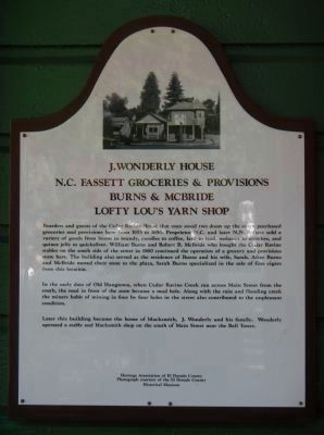
Photographed by Barry Swackhamer, May 4, 2013
1. J. Wonderly House / N.C. Fassett Groceries & Provisions / Burn & McBride / Lofty Lou’s Yarn Shop Marker
Photo on marker courtesy of the El Dorado County Museum.
In the early days of Old Hangtown, when Cedar Ravine Creek ran across Main Street from the south, the road in front of the store became a mud hole. Along with the rain and flooding creek the miners habit of mining in four by four holes in the street also contributed to the unpleasant conditions.
Later this building became the home of blacksmith, J. Wonderly and his family. Wonderly operated a stable and blacksmith shop on the south of Main Street near the Bell
this page online
Erected by Heritage Association of El Dorado County.
Topics. This historical marker is listed in this topic list: Industry & Commerce. A significant historical year for this entry is 1853.
Location. 38° 43.744′ N, 120° 47.803′ W. Marker is in Placerville, California, in El Dorado County. It is at the intersection of Main Street and Clay Street, on the left when traveling east on Main Street. Touch for map. Marker is at or near this postal address: 585 Main Street, Placerville CA 95667, United States of America. Touch for directions.

Regionally, this marker is in California’s Sacramento Metro, in the Gold Country, in the Sierra Nevada, and in the Lake Tahoe Basin. It is also in the American Mountain West. Globally, it is in North America, on the Ring of Fire, in the Pacific Rim, in the Western Hemisphere, in the Western World, and in the Anglosphere. Historically, it finds itself in what was once New Spain and also Mexico’s Alta California.
Other nearby markers. At least 8 other markers are within walking distance of this marker: Upper Central House (a few steps from this marker); The Druid Monument
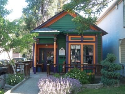
Photographed by Barry Swackhamer, May 4, 2013
2. J. Wonderly House Marker
Credits. This page was last revised on December 9, 2024. It was originally submitted on May 10, 2013, by Barry Swackhamer of Brentwood, California. This page has been viewed 898 times since then and 14 times this year. Photos: 1, 2. submitted on May 10, 2013, by Barry Swackhamer of Brentwood, California. • Syd Whittle was the editor who published this page.
