Goldfield in Esmeralda County, Nevada — The American Mountains (Southwest)
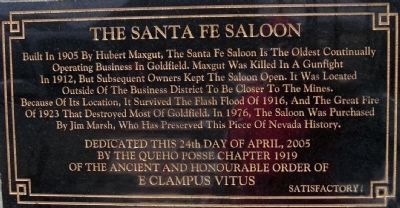
The Santa Fe Saloon
Photographed by Lester J Letson, July 17, 2009
1. Santa Fe Saloon Marker
Erected 2005 by Queho Posse Chapter 1919, E Clampus Vitus.
Topics and series. This historical marker is listed in this topic list: Industry & Commerce. In addition, it is included in the E Clampus Vitus series list. A significant historical year for this entry is 1905.
Location. 37° 42.8′ N, 117° 13.817′ W. Marker is in Goldfield, Nevada, in Esmeralda County. It is at the intersection of 5th Avenue and Pearl Street, on the left when traveling north on 5th Avenue. Touch for map. Marker is at or near this postal address: 925 North 5th Avenue, Goldfield NV 89013, United States of America. Touch for directions.

Regionally, this marker is
this page online
Other nearby markers. At least 8 other markers are within walking distance of this marker: Combination Mine Headframe (within shouting distance of this marker); California Beer Hall Warehouse (approx. 0.3 miles away); Consolidated Telephone-Telegraph Company Building (approx. 0.4 miles away); Nixon Wingfield Building (approx. 0.4 miles away); Goldfield (approx. 0.4 miles away); Goldfield Community Center (approx. 0.4 miles away); Gans vs. Nelson (approx. 0.4 miles away); The Gables (approx. half a mile away). Touch for a list and map of all markers in Goldfield.
Another marker is no longer nearby. Southern Nevada Consolidated Telephone-Telegraph Company Building (was approx. 0.4 miles away but has been replaced with another marker now near it).
Regarding The Santa Fe Saloon. From Las Vegas Leisure Guide-Ghost
Photographed by Lester J Letson, July 17, 2009
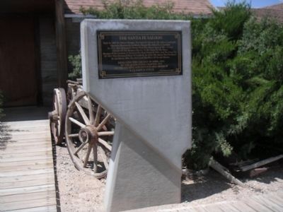
2. The Sante Fe Saloon Marker
To the left of the entrance to the Sante Fe Saloon.
"Once this was Nevada's largest city after gold was discovered in 1902. It was known for its opulence and luxury, seldom seen in mining towns. Goldfield, also called the "Queen of Camps" had over 20,000 residents at its peak. Its mines produced $10,000 a day back in 1907 which made the five banks in town very happy. It even had several mining stock exchanges, three newspapers and five railroads. Goldfield became national recognized when they held a prize fight to bolster mining investments. The fight, recorded in the Guinness Book of Records went 42 rounds between Joe Gans and Battling Nelson. Nelson was disqualified for a "vicious foul" and Joe Gans won the Lightweight Championship of the World. A flood in 1913 and a fire in 1923 destroyed much of Goldfield's past but there is still much history to see today. The famous "Tex" Rickard house is standing, along with the courthouse which was built in 1907 for a meager $140,000. And don't miss the Santa Fe Saloon built in 1905. The miners got more than a few drinks at this place by the look of the small beds out back!"
Source:
http://www.lvlg.com/lasvegas/attracts/ghstwns.htm
Additional keywords. mining
Photographed by Douglass Halvorsen, March 31, 2018
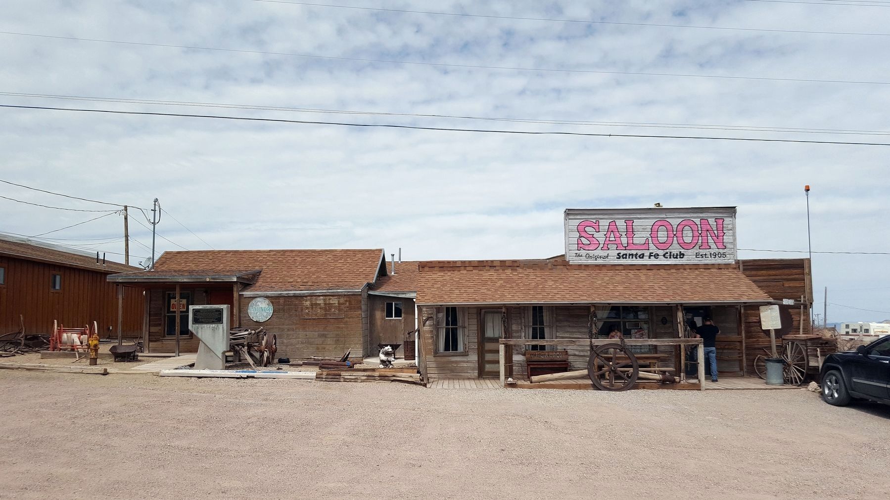
3. Santa Fe Saloon and Marker
Photographed by Douglass Halvorsen, March 31, 2018
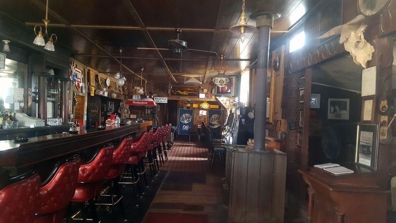
4. The Santa Fe Saloon interior
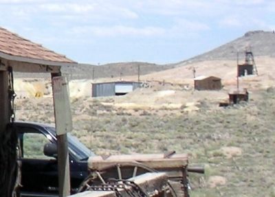
Photographed by Lester J Letson, July 17, 2009
5. Abandoned Mine
Viewed from the Santa Fe Saloon front porch. There are several abandoned mines on the horizon.
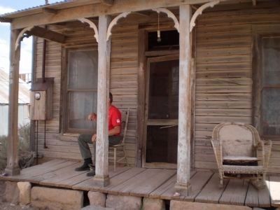
Photographed by Lester J Letson, July 17, 2009
6. House Across the Street from the Motel
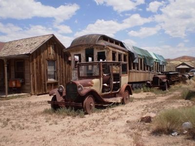
Photographed by Lester J Letson, July 17, 2009
7. Railroad Passenger Car and Automobiles
Across from the Santa Fe Saloon.
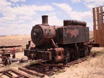
Photographed by Lester J Letson, July 17, 2009
8. Old Locomotive
Located across from the Santa Fe Saloon where local residents are restoring the old roundhouse and service barn with plans to eventually open a railroad museum.
Credits. This page was last revised on May 8, 2026. It was originally submitted on August 10, 2010, by Lester J Letson of Fresno, California. This page has been viewed 2,176 times since then and 97 times this year. Last updated on May 17, 2013, by Richard E. Miller of Oxon Hill, Maryland. Photos: 1, 2. submitted on August 10, 2010, by Lester J Letson of Fresno, California. 3, 4. submitted on April 12, 2018, by Douglass Halvorsen of Klamath Falls, Oregon. 5, 6, 7, 8. submitted on August 10, 2010, by Lester J Letson of Fresno, California. • Syd Whittle was the editor who published this page.
