Nazareth, Northern District, Israel — West Asia (the Levant in the Middle East)
The Ancient Village of Nazareth
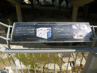
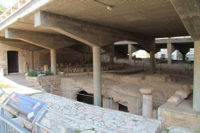
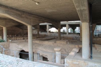
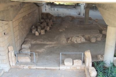
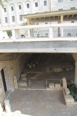
What is left of the ancient village consist of a network of grottoes and bits of walls form various historical periods. Going backwards in time we found first the remains of the XVII century Franciscan monastery, then the palace of the crusader archbishop of Nazareth and the humble homes with some parts datable up to the VIII cent. B.C.
The parts that were carved out of the soft local rock are the best preserved: cistern for storing rainwater, silos set on different levels for storing foodstuff, a winepress, cellars for full jars, stables with mangers for the live stock, a bread oven.
The part farthest to the east is traditionally known as the "Virgin's kitchen" because of its proximity to the sacred grotto.
Topics. This historical marker is listed in these topic lists: Anthropology & Archaeology • Churches & Religion • Settlements & Settlers.
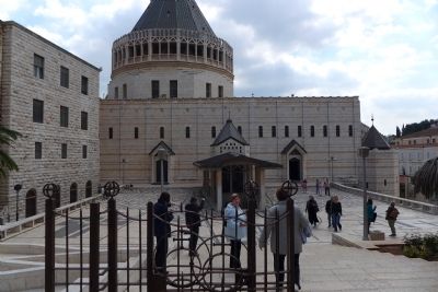
Location. 32° 42.138′ N, 35° 17.868′ E. Marker is in Nazareth, Northern District. Marker can be reached from Al-Bishara Street, 0.3 kilometers north of Paulus ha-Shishi Street, on the right when traveling north. This marker is located on the grounds of the Basilica of the Annunciation. Touch for map. Marker is at or near this postal address: Al-Bishara Street 12, Nazareth, Northern District, Israel. Touch for directions.
Other nearby markers. At least 8 other markers are within 14 kilometers of this marker, measured as the crow flies. Basilica of the Annunciation (a few steps from this marker); Architectural Elements of the Church-Synagogue (a few steps from this marker); Byzantine Mosaics (a few steps from this marker); The Church of St. Joseph (about 90 meters away, measured in a direct line); Mount of Precipice (approx. 2.4 kilometers away); The Citadel (approx. 5.9 kilometers away); The Theater (approx. 5.9 kilometers away); Ancient Yodfat (approx. 14.6 kilometers away). Touch for a list and map of all markers in Nazareth.
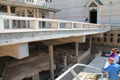
More about this marker. This marker is situated along the backside (north side) of the basilica, and is attached to the railing along the outside steps, that come down from the back, elevated plaza, and allows visitors to see the archaeological ruins beneath the basilica's plaza. In fact, it is part of a modest display of an archaeological excavation, that is covered by the upper level outdoor plaza of the basilica.
Also see . . .
1. Basilica of Annunciation. This is a link to information provided by the BibleWalks.com website. (Submitted on May 21, 2013, by Dale K. Benington of Toledo, Ohio.)
2. Basilica of the Annunciation. This is a link to information provided by Wikipedia, the free encyclopedia. (Submitted on May 21, 2013, by Dale K. Benington of Toledo, Ohio.)
3. Basilica of the Annunciation, Nazareth. This is a link to information provided by an online travel guide to sacred sites called Sacred Destinations. (Submitted on May 21, 2013, by Dale K. Benington of Toledo, Ohio.)
Photographed By Dale K. Benington, March 6, 2013
4. The Ancient Village of Nazareth Marker
View of the historical marker in the lower right hand side of the picture, situated between the members of a tour group. Both the historical marker and the archaeological display are at the lower level of the church, beneath an upper level plaza.
Credits. This page was last revised on November 11, 2022. It was originally submitted on May 21, 2013, by Dale K. Benington of Toledo, Ohio. This page has been viewed 589 times since then and 12 times this year. Photos: 1, 2, 3, 4, 5, 6, 7, 8. submitted on May 21, 2013, by Dale K. Benington of Toledo, Ohio.
