Rustburg in Campbell County, Virginia — The American South (Mid-Atlantic)
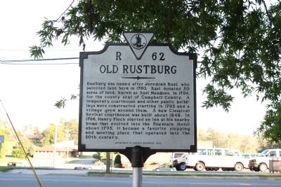
Old Rustburg
Erected 2000 by Department of Historic Resources. (Marker Number R-62.)
Topics and series. This historical marker is listed in these topic lists: Architecture • Government & Politics • Industry & Commerce • Settlements & Settlers. In addition, it is included in the Virginia Department of Historic Resources (DHR) series list. A significant historical year for this entry is 1780.
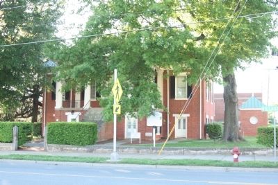
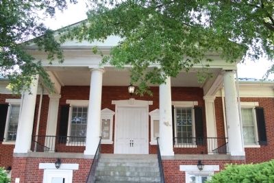
Location. 37° 16.613′ N, 79° 6.069′ W. Marker is in Rustburg, Virginia, in Campbell County. Marker is on Village Highway (Route 501) near Rails End Lane (County Route 838), on the right when traveling south. It is in front of the courthouse. Marker is mounted with its face is parallel to the street so it is hard to spot in the distance from a moving vehicle. Touch for map. Marker is in this post office area: Rustburg VA 24588, United States of America. Touch for directions.
Other nearby markers. At least 8 other markers are within 8 miles of this marker, measured as the crow flies. Campbell County War Memorial (about 300 feet away, measured in a direct line); Campbell County Training School (approx. 0.6 miles away); Original Site of Campbell County Training-High School (approx. 0.9 miles away); Col. Vincent W. “Squeek” Burnett (approx. 3.4 miles away); Montview (approx. 6.6 miles away); Lynchburg Defenses (approx. 7.1 miles away); Chestnut Hill (approx. 7.4 miles away); Oxford Furnace (approx. 7.6 miles away). Touch for a list and map of all markers in Rustburg.
More about this marker. This marker replaced a marker from the 1930s with the same name and number that read “The place was named for Jeremiah Rust, who patented land here in 1780. The first courthouse of Campbell County was built here, in 1783; the present building was erected about 1848. The old ‘Fountain Hotel’ was built in 1795 and has been conducted by the Finch family ever since.”
Also see . . . Campbell Chronicles and Family Sketches, Chapter IV, Small Towns and Villages. Transcript of 1927 book by R. H. Early. Rustburg is the second entry. “Long Mountain, rising above the meadow upon which the town of Rustburg is situated, at one time bore the name of Rust’s Mountain; It stretches the length of six or more miles, and a cave on one side is said to have harbored Tories and outlaws during the Revolution. It is one of two detached mountain ranges in the county, the other being Candler’s Mountain.” (Submitted on May 28, 2013.)
Credits. This page was last revised on August 6, 2020. It was originally submitted on May 28, 2013, by J. J. Prats of Powell, Ohio. This page has been viewed 993 times since then and 119 times this year. Photos: 1, 2, 3. submitted on May 28, 2013, by J. J. Prats of Powell, Ohio.
Editor’s want-list for this marker. Photos of the Fountain Hotel • Can you help?


