Yosemite National Park in Mariposa County, California — The American West (Pacific Coastal)
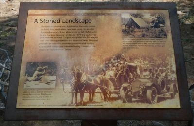
A Storied Landscape
Photographed by Barry Swackhamer, May 18, 2013
1. A Storied Landscape Marker
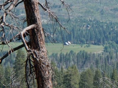
Photograph Captions: (bottom left) American Indians gather acorns from oak trees and use bedrock mortars to pound them into flour. They harvest milkweed, deergrass, and bracken fern. (Mary pounding acorn, Yosemite Valley, c. 1913; (top right) Off in the distance, you can see where German immigrant George Meyer built two barns in the early 1880s. The National Park Service restored them in 1996. They feature hand-hewn timbers, peeled logs, fieldstone foundations, and hand-split sugar pine roof shakes.
Erected by Yosemite Fund.
Topics. This historical marker is listed in this topic list: Settlements & Settlers. A significant historical year for this entry is 1874.
Location. 37° 44.37′ N, 119° 46.018′ W. Marker is in Yosemite National Park, California, in Mariposa County. It is on Big Oak Flat Road, on the right when traveling south. Touch for map. Marker is in this post office area: Yosemite National Park CA 95389, United States of America. Touch for directions.

Regionally, this marker is in California’s Sierra Nevada. It is also in the American Mountain West. Globally, it is in North America, the Pacific Rim, the
this page online
Other nearby markers. At least 8 other markers are within 7 miles of this marker, measured as the crow flies: Waterfalls of Yosemite Valley (approx. 3.2 miles away); The Journey to Yosemite (approx. 3.2 miles away); Yosemite Valley Railroad (approx. 4.6 miles away); Rewards of Travel (approx. 5.2 miles away); President Theodore Roosevelt & John Muir Meeting Site (approx. 6.1 miles away); Disappearing Waterfalls (approx. 6½ miles away); Glaciers at the Gate (approx. 6.6 miles away); El Capitan (approx. 6.6 miles away). Touch for a list and map of all markers in Yosemite National Park.
Another marker is no longer nearby. Yosemite Valley's First Visit by White Men (was approx. 5.2 miles away but has been confirmed missing).
More about this marker. This marker is located at the Big Meadow Overlook.
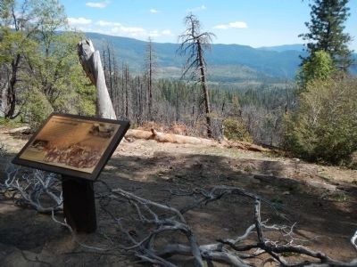
Photographed by Barry Swackhamer, May 18, 2013
2. A Storied Landscape Marker
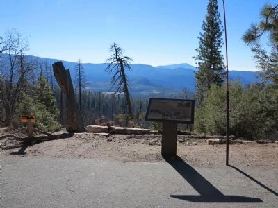
Photographed by Richard Denney, November 25, 2013
3. A Storied Landscape Marker
Another view of the marker with Meyer's Barns and Big Meadow in background.
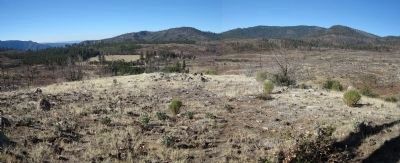
Photographed by Richard Denney, November 25, 2013
4. Meyer's Barns and Big Meadow
Panoramic view of Meyer's Barns, Big Meadow and surrounding area. Notice burned forest from the "Rim Fire" of 2013.
Photographed by Barry Swackhamer, May 18, 2013
5. The Meyer's Barns and Big Meadow From the Overloook
Credits. This page was last revised on June 16, 2016. It was originally submitted on May 28, 2013, by Barry Swackhamer of Brentwood, California. This page has been viewed 680 times since then and 22 times this year. Photos: 1, 2. submitted on May 28, 2013, by Barry Swackhamer of Brentwood, California. 3, 4. submitted on November 29, 2013, by Richard Denney of Austin, Texas. 5. submitted on May 28, 2013, by Barry Swackhamer of Brentwood, California. • Syd Whittle was the editor who published this page.
