Ulysses in Grant County, Kansas — The American Midwest (Upper Plains)
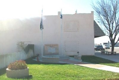
Veterans Memorial
All gave some, Some gave all

Photographed by William Fischer, Jr., November 11, 2012
1. Veterans Memorial Marker
Topics. This memorial is listed in this topic list: Military.
Location. 37° 34.763′ N, 101° 21.469′ W. Memorial is in Ulysses, Kansas, in Grant County. It is at the intersection of Main Street and Central Avenue, on the left when traveling south on Main Street. Touch for map. Memorial is in this post office area: Ulysses KS 67880, United States of America. Touch for directions.

Regionally, this memorial is in the American Midwest, in the Corn Belt, on the prairies, on the Great Plains, on the Southern Plains, and specifically on the High Plains. Globally, it is in North America, the Western Hemisphere, the Western World, and the Anglosphere. Historically, it finds itself in what was once the Comanchería, the Dust Bowl, the Louisiana Purchase, and the Republic of Texas.
Other nearby markers. At least 6 other markers are within 12 miles of this marker, measured as the crow flies: Grant County Shop (Adobe) Building (approx. ¼ mile away); a different marker also named Veterans Memorial (approx. ¼ mile away); Dan C. Sullivan
this page online
Photographed by William Fischer, Jr., November 11, 2012
2. Veterans Memorial
Photographed by William Fischer, Jr., November 11, 2012
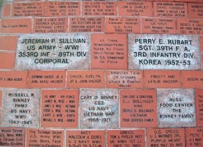
3. Veterans Memorial Pavers
Credits. This page was last revised on September 3, 2020. It was originally submitted on June 6, 2013, by William Fischer, Jr. of Reynoldsburg, Ohio. This page has been viewed 574 times since then and 21 times this year. Photos: 1, 2, 3. submitted on June 6, 2013, by William Fischer, Jr. of Reynoldsburg, Ohio.
