Whitetop in Grayson County, Virginia — The American South (Mid-Atlantic)
“Virginia Creeper” Railroad
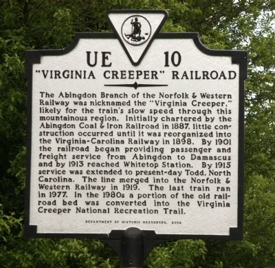
The Abingdon Branch of the Norfolk & Western Railway was nicknamed the “Virginia Creeper,” likely for the train’s slow speed through this mountainous region. Initially chartered by the Abingdon Coal & Iron Railroad in 1887, little construction occurred until it was reorganized into the Virginia-Carolina Railway in 1898. By 1901 the railroad began providing passenger and freight service from Abingdon to Damascus and by 1913 reached Whitetop Station. By 1915 service was extended to present-day Todd, North Carolina. The line merged into the Norfolk & Western Railway in 1919. The last train ran in 1977. In the 1980s a portion of the old railroad bed was converted into the Virginia Creeper National Recreation Trail.
Erected 2002 by Department of Historic Resources. (Marker Number UE-10.)
Topics and series. This historical marker is listed in this topic list: Railroads & Streetcars. In addition, it is included in the Virginia Department of Historic Resources (DHR) series list. A significant historical year for this entry is 1887.
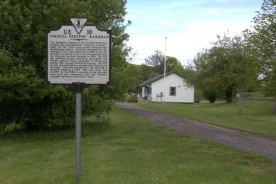
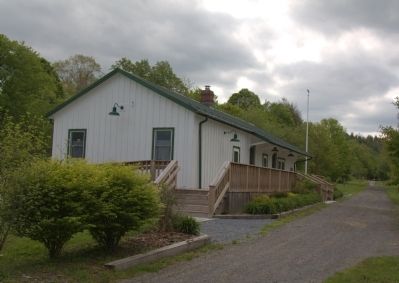
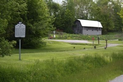
Location. 36° 35.977′ N, 81° 37.575′ W. Marker is in Whitetop, Virginia, in Grayson County. Marker is at the intersection of Whitetop Gap Road (County Route 726) and Old Park Road (County Route 755) on Whitetop Gap Road. It is at the reproduction of Whitetop Station on the Virginia Creeper National Recreation Trail. Touch for map. Marker is in this post office area: Whitetop VA 24292, United States of America. Touch for directions.
Other nearby markers. At least 8 other markers are within 3 miles of this marker, measured as the crow flies. Christmas Tree Farms (about 400 feet away, measured in a direct line); Trestle Construction (approx. 0.7 miles away); Old Growth Forest Remnants (approx. one mile away); The Offset (approx. 1.3 miles away); Green Cove Station (approx. 1.7 miles away); “Maud Bows to The Virginia Creeper” (approx. 1.7 miles away); Whitetop (approx. 1.8 miles away); White Top Folk Festival (approx. 3 miles away). Touch for a list and map of all markers in Whitetop.
Regarding “Virginia Creeper” Railroad. This railroad line had the highest point on rails east of the Rocky Mountains ever reached by a scheduled passenger train, 3,557 feet above sea level.
Also see . . . Virginia Creeper Trail. Wikipedia entry:
“The trail runs on a rail right-of-way dating to the 1880s — first belonging to the Abingdon Coal and Iron Railroad. After investing sizable capital without actually opening, that company went out of business. In the early 1890s the company's assets were purchased by the Virginia-Carolina and Southern Railway. It too had financial trouble and its assets were purchased by the Virginia-Carolina Railway.
“In February 1900, the Virginia-Carolina
Railway began operating in Damascus, Virginia. By 1912, the railroad extended to Whitetop and by the end of the decade to Elkland, North Carolina (now Todd). The train ran to Todd until 1933, when the terminus moved to West Jefferson.
“In 1957 the last steam engine retired, replaced by diesel powered engines. By 1974, the Norfolk and Western Railroad Company petitioned the Interstate Commerce Commission to abandon the line. In 1977 hard rains flooded and damaged most of the line, which was left un-repaired.
“In 1977 removal of the track began and the land in Virginia was secured by the US Forest Service for a recreation trail. The land in North Carolina was returned to the land owners. In Virginia, the right-of-way is owned by the Towns of Abingdon and Damascus, and by the National Park Service and the National Forest Service.” (Submitted on June 8, 2013.)
Credits. This page was last revised on June 18, 2023. It was originally submitted on June 8, 2013, by J. J. Prats of Powell, Ohio. This page has been viewed 893 times since then and 37 times this year. Photos: 1, 2, 3, 4. submitted on June 8, 2013, by J. J. Prats of Powell, Ohio.


