Providence in Halifax County, Virginia — The American South (Mid-Atlantic)
Halifax Church
Photographed By Bernard Fisher, June 15, 2013
1. Halifax Church Marker
Inscription.
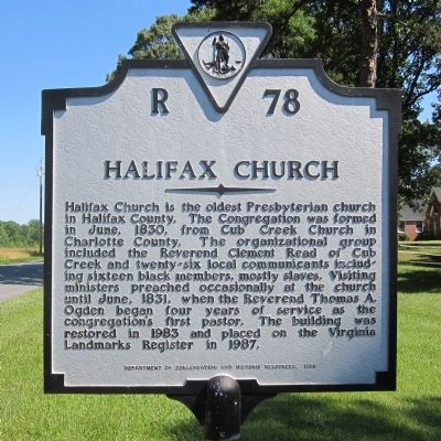
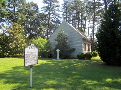
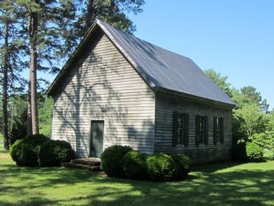
Halifax Church is the oldest Presbyterian church in Halifax County. The Congregation was formed in June, 1830, from Cub Creek Church in Charlotte County. The organizational group included the Reverend Clement Read of Cub Creek and twenty-six local communicants including sixteen black members, mostly slaves. Visiting ministers preached occasionally at the church until June, 1831, when the Reverend Thomas A. Ogden began four years of service as the congregation's first pastor. The building was restored in 1983 and placed on the Virginia Landmarks Register in 1987.
Halifax Church is the oldest Presbyterian church in Halifax County. The Congregation was formed in June, 1830, from Cub Creek Church in Charlotte County. The organizational group included the Reverend Clement Read of Cub Creek and twenty-six local communicants including sixteen black members, mostly slaves. Visiting ministers preached occasionally at the church until June, 1831, when the Reverend Thomas A. Ogden began four years of service as the congregation's first pastor. The building was restored in 1983 and placed on the Virginia Landmarks Register in 1987.
Erected 1988 by Department of Conservation and Historic Resources. (Marker Number R-78.)
Location. 36° 56.266′ N, 78° 49.183′ W. Marker is in Providence, Virginia, in Halifax County. Marker is at the intersection of Cole Ferry Road (Virginia Route 624) and Morton's Ferry Road (Virginia Route 623), on the right when traveling north on Cole Ferry Road. Touch for map. Marker is in this post office area: Nathalie VA 24577, United States of America. Touch for directions.
Other nearby markers. At least 8 other markers are within 8 miles of this marker, measured as the
Credits. This page was last revised on June 16, 2016. It was originally submitted on June 16, 2013, by Bernard Fisher of Richmond, Virginia. This page has been viewed 312 times since then and 13 times this year. Photos:1, 2, 3. submitted on June 16, 2013, by Bernard Fisher of Richmond, Virginia.