Near Westwood in Lassen County, California — The American West (Pacific Coastal)
The Chimney
Photographed by Barry Swackhamer, June 5, 2013
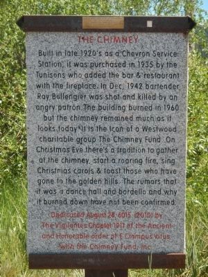
1. The Chimney Marker
A small brass plaque on top of the marker reads:
For a video slide show of this project get into Facebook. Search for Chimney Fund. Click on Chimney Fund + others. Look at Tunison Cafe.
Erected 2010 by E Clampus Vitus, The Vigilantes Chapter No. 1911 & The Chimney Fund.
Topics and series. This historical marker is listed in this topic list: Notable Buildings. In addition, it is included in the E Clampus Vitus series list. A significant historical month for this entry is December 1942.
Location. 40° 19.472′ N, 120° 56.242′ W. Marker is near Westwood, California, in Lassen County. It is on California Route 36 at milepost 6.9, on the right when traveling east. Touch for map. Marker is in this post office area:
this page online

Regionally, this marker is on the Modoc Plateau and in the Shasta Cascade. It is also in the American Mountain West. Globally, it is in North America, on the Ring of Fire, on the Pacific Rim, in the Western Hemisphere, in the Western World, and in the Anglosphere. Historically, it finds itself in what was once New Spain and also Mexico’s Alta California.
Other nearby markers. At least 8 other markers are within 4 miles of this marker, measured as the crow flies: Chuck’s Railroad Room (approx. 3.6 miles away); Red River Bakery (approx. 3.7 miles away); Boardinghouses (approx. 3.7 miles away); Westwood Club (approx. 3.7 miles away); Paul Bunyan (approx. 3.7 miles away); Westwood Firehouse (approx. 3.7 miles away); Lassen Trail - Westwood (approx. 3.7 miles away); Westwood (approx. 3.7 miles away). Touch for a list and map of all markers in Westwood.
Photographed by Barry Swackhamer, June 5, 2013
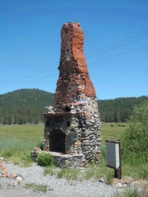
2. The Chimney and Marker
Credits. This page was last revised on June 16, 2016. It was originally submitted on June 17, 2013, by Barry Swackhamer of Brentwood, California. This page has been viewed 1,723 times since then and 127 times this year. Photos: 1. submitted on June 17, 2013, by Barry Swackhamer of Brentwood, California. 2. submitted on July 28, 2013, by Barry Swackhamer of Brentwood, California. • Syd Whittle was the editor who published this page.
