Near Belden in Plumas County, California — The American West (Pacific Coastal)
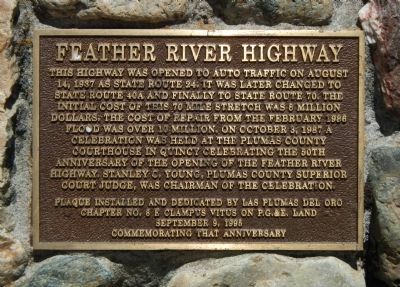
Feather River Highway
Erected 1995 by E Clampus Vitus, Las Plumas del Oro Chapter No. 8.
Topics and series. This historical marker is listed in this topic list: Roads & Vehicles. In addition, it is included in the E Clampus Vitus series list. A significant historical month for this entry is February 1986.
Location. 40° 0.431′ N, 121° 15.05′ W. Marker is near Belden, California, in Plumas County. Marker is on Feather River Highway (California Route 70), on the left when traveling east. Touch for map. Marker is at or near this postal address: 4723 Highway 70, Belden CA 95915, United States of America. Touch for directions.
Other nearby markers. At least 8 other markers are within 10 miles of this marker, measured as the crow flies. Eby Stamp Mill (within shouting distance of this marker); Pacific Crest Trail (about 400 feet away, measured in a direct line); Belden (about 500 feet away); Rich Bar (approx. 3.1 miles away); Old Lake House (approx. 7˝ miles away); Tasman Koyom (approx. 9.3 miles away); Humbug Valley (approx. 9.3 miles away); Soda Spring (approx. 9.3 miles away). Touch for a list and map of all markers in Belden.
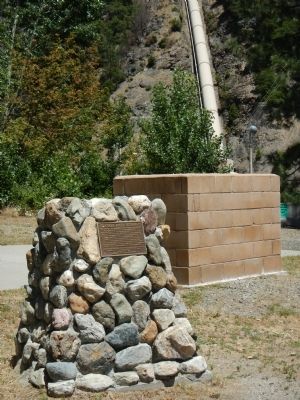
More about this marker. This marker is located at the rest stop west of Yellow Creek bridge and the Belden Power Plant.
Credits. This page was last revised on June 16, 2016. It was originally submitted on June 20, 2013, by Barry Swackhamer of Brentwood, California. This page has been viewed 480 times since then and 16 times this year. Photos: 1, 2. submitted on June 20, 2013, by Barry Swackhamer of Brentwood, California. • Syd Whittle was the editor who published this page.

