Stockton in Baldwin County, Alabama — The American South (East South Central)
Stockton Presbyterian Church
Organized 1847
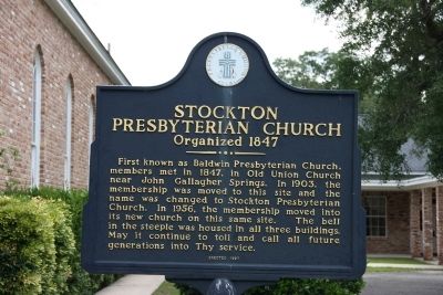
Photographed by TRCP Alliance, June 22, 2013
1. Stockton Presbyterian Church Marker
Erected 1997 by Presbyterian Church U.S.A.
Topics. This historical marker is listed in this topic list: Religion & Religious Structures. A significant historical year for this entry is 1847.
Location. 31° 0.176′ N, 87° 51.188′ W. Marker is in Stockton, Alabama, in Baldwin County. It is on Old Stage Road north of Alabama Route 59, on the left when traveling north. Touch for map. Marker is at or near this postal address: 53320 Alabama 59, Stockton AL 36579, United States of America. Touch for directions.

Regionally, this marker is on the Gulf Coast and in the Mobile Bay area. It is also in the American South, specifically in the Deep South, and on the Gulf Coast. Globally, it is in North America,
this page online
Other nearby markers. At least 8 other markers are within 3 miles of this marker, measured as the crow flies: Bartram’s Trail (approx. 0.4 miles away); The Mound Line (approx. half a mile away); Historic Stockton / Old Schoolyard Park (approx. 0.6 miles away); Major Robert Farmar Plantation (approx. 1.6 miles away); Public Education in Baldwin County / Little Red Schoolhouse Historic Site (approx. 2.3 miles away); Baldwin County Vietnam War Memorial (approx. 2.4 miles away); Baldwin County Korean War Monument (approx. 2.4 miles away); All Gave Some - Some Gave All (approx. 2.4 miles away). Touch for a list and map of all markers in Stockton.
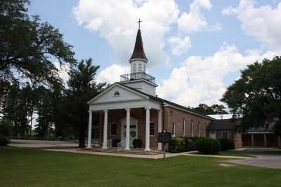
Photographed by TRCP Alliance, June 22, 2013
2. Stockton Presbyterian Church & Marker
Credits. This page was last revised on June 16, 2016. It was originally submitted on June 29, 2013, by Timothy Carr of Birmingham, Alabama. This page has been viewed 1,157 times since then and 19 times this year. Photos: 1, 2. submitted on June 29, 2013, by Timothy Carr of Birmingham, Alabama. • Bill Pfingsten was the editor who published this page.
