
Baltimore Hundred in Ocean View in Sussex County, Delaware — The American Northeast (Mid-Atlantic)
Our Community's Role in World War II
U.S. Army Radar Site 11
| — | The Village at Bear Trap Dunes | — |

Photographed by Devry Becker Jones (CC0), June 13, 2026
1. Our Community's Role in World War II Marker
During the 1930’s the United States began preparations to protect the areas along the Atlantic Coastline. To accomplish this many systems were installed around the seaports and shipping lanes of major cities such as New York, Philadelphia and Baltimore. In Delaware the U.S. Army established a large defensive fortification known as Fort Miles in Lewes. Fort Miles depended upon early warning systems and fire control information provided by a network of resources positioned along the shoreline. A system of 26 radar sites, using radio wave technology, stretched from Maine to Virginia, and concrete watch towers were manned by service personnel using binoculars and telescopes to focus in the horizon for enemy activity.
Erected by The Village at Bear Trap Dunes.
Topics. This historical marker is listed in this topic list: War, World II.
Location. 38° 31.5′ N, 75° 6.483′ W. Marker is in Ocean View, Delaware, in Sussex County. It is in Baltimore Hundred. It is on Magnolia Street. The marker is about 25 feet down the path from the road. Touch for map. Marker is in this
this page online

Regionally, this marker is on Delaware’s Beaches. It is also in the American Mid-Atlantic, on the Delmarva Peninsula, and on the Eastern Seaboard. Globally, it is in the North Atlantic Region, North America, the Western Hemisphere, the Western World, and the Anglosphere. Historically, it finds itself in what was once New Netherland, one of the original Thirteen Colonies, and the Antebellum South.
Other nearby markers. At least 8 other markers are within 2 miles of this marker, measured as the crow flies: A different marker also named Our Community's Role in World War II (here, next to this marker); U.S. Army Radar Site 11 (within shouting distance of this marker); a different marker also named Our Community's Role in World War II (within shouting distance of this marker); Nugget Hollow & G.P. Mining Co. (approx. 1½ miles away); Mariner’s Bethel United Methodist Church (approx. 1.6 miles away); Ocean View Presbyterian Church (approx. 1.7 miles away); Coastal Towns Museum (approx. 1.9 miles away); Veterans Memorial (approx. 1.9 miles away).
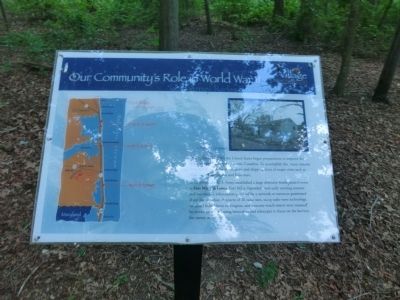
Photographed by Don Morfe, May 29, 2013
2. Our Community's Role in World War II Marker
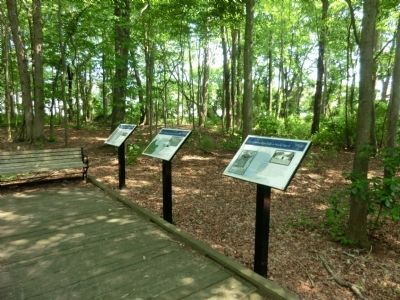
Photographed by Don Morfe, May 29, 2013
3. Our Community's Role in World War II Marker
A photo of this marker which is the one on the far left
Photographed by Don Morfe, May 29, 2013
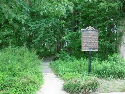
4. Our Community's Role in World War II Marker
This photo shows the path from the road to the marker
Photographed by Don Morfe, May 29, 2013
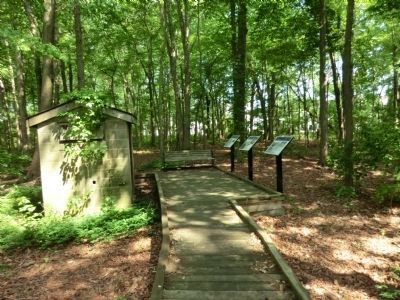
5. Our Community's Role in World War II Marker
This photo shows the Pump House, the only remaining building from the site and the three markers.
Credits. This page was last revised on June 25, 2026. It was originally submitted on July 6, 2013, by Don Morfe of Baltimore, Maryland. This page has been viewed 540 times since then and 15 times this year. Photos: 1. submitted on June 13, 2026, by Devry Becker Jones of Washington, District of Columbia. 2, 3, 4, 5. submitted on July 6, 2013, by Don Morfe of Baltimore, Maryland. • Bill Pfingsten was the editor who published this page.
