
Ocean City in Worcester County, Maryland — The American Northeast (Mid-Atlantic)
Town of Ocean City
Boardwalk Expansion and Comfort Station Renovation
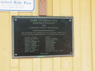
Photographed by Don Morfe, May 30, 2013
1. Town of Ocean City Marker
Erected 1991.
Topics. This historical marker is listed in these topic lists: Industry & Commerce • Railroads & Streetcars.
Location. 38° 21.333′ N, 75° 4.4′ W. Marker is in Ocean City, Maryland, in Worcester County. It is on Ocean City Boardwalk at 27th Street. This marker is at the north end Tram Station. Touch for map. Marker is in this post office area: Ocean City MD 21842, United States of America. Touch for directions.

Regionally, this marker is on the Eastern Shore. It is also in the American Mid-Atlantic, on the Delmarva Peninsula, in the Tidewater, and on the Eastern Seaboard. Globally,
this page online
Other nearby markers. At least 8 other markers are within 2 miles of this marker, measured as the crow flies: World War I (approx. 0.2 miles away); Smaller Conflicts After WWII (approx. 0.2 miles away); World War II (approx. 0.2 miles away); Korean War (approx. 0.2 miles away); a different marker also named World War II (approx. 0.2 miles away); "Bay Breeze" (approx. 1.3 miles away); Students of Ocean City High School in World War II (approx. 1.6 miles away); St. Paul's By-The-Sea Episcopal Church (approx. 1.6 miles away). Touch for a list and map of all markers in Ocean City.
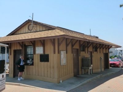
Photographed by Don Morfe, May 30, 2013
2. Town of Ocean City Marker
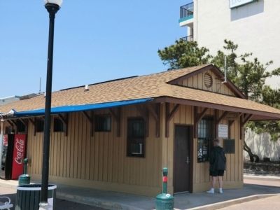
Photographed by Don Morfe, May 30, 2013
3. Town of Ocean City Marker
Credits. This page was last revised on June 16, 2016. It was originally submitted on July 7, 2013, by Don Morfe of Baltimore, Maryland. This page has been viewed 497 times since then and 15 times this year. Photos: 1, 2, 3. submitted on July 7, 2013, by Don Morfe of Baltimore, Maryland. • Bill Pfingsten was the editor who published this page.
