Deal Island in Somerset County, Maryland — The American Northeast (Mid-Atlantic)
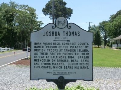
Joshua Thomas
1776-1853
Photographed by Don Morfe, May 31, 2013
1. Joshua Thomas Marker
Erected by Maryland Historical Society.
Topics and series. This memorial is listed in these topic lists: Religion & Religious Structures • War of 1812. In addition, it is included in the Maryland Historical Trust series list. A significant historical year for this entry is 1814.
Location. 38° 9.298′ N, 75° 56.916′ W. Memorial is on Deal Island, Maryland, in Somerset County. It is on Deal Island Road. Touch for map. Memorial is in this post office area: Deal Island MD 21821, United States of America. Touch for directions.

Regionally, this memorial is on the Eastern Shore. It is also in the American Mid-Atlantic, on the Delmarva Peninsula, in the Tidewater, in the Chesapeake Bay Region, and on the Eastern Seaboard. Globally, it is in the North Atlantic Region, North America, the Western Hemisphere, the Western World, and the
this page online
Other nearby markers. At least 8 other markers are within 12 miles of this marker, measured as the crow flies: Henry's Beach (approx. 3.6 miles away); Roaring Point Park (approx. 8 miles away); a different marker also named Roaring Point Park (approx. 8 miles away); Gen. Arnold Elzey C.S.A. (approx. 8.3 miles away); Saint Stephen's Church (approx. 9.1 miles away); "Bloomsbury" (approx. 9.1 miles away); Old Ailsey's Light (approx. 11.2 miles away); Fields and Pastures (approx. 11.2 miles away).
Photographed by Don Morfe, May 31, 2013
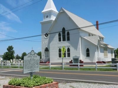
2. Joshua Thomas Marker
The marker is in front of St. John's Church
Photographed by Don Morfe, May 31, 2013
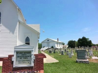
3. Joshua Thomas Marker
St. John's Methodist Church and Joshua Thomas Chapel located behind the church.
Photographed by Don Morfe, May 31, 2013
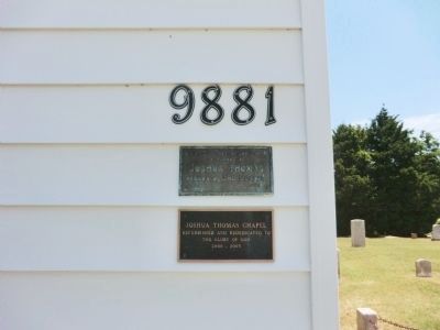
4. Joshua Thomas Marker
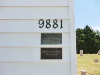
(top plaque) To the glory of God, in Memory of Joshua Thomas, Parson of the Islands.
1776-1850
(bottom plaque) Joshua Thomas Chapel, refurbished and rededicated to the Glory of God
2000-2003
Photographed by Don Morfe, May 31, 2013
5. Joshua Thomas Marker
Photographed by Don Morfe, May 31, 2013
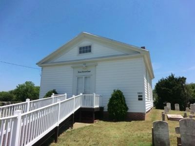
6. Joshua Thomas Chapel
Markers are located on the front on the right side.
Photographed by Don Morfe, May 31, 2013
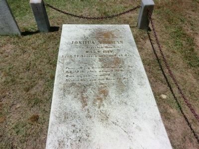
7. Joshua Thomas Marker
Joshua Thomas grave marker located in St John's Cemetery and it is near the Chapel that bears his name.
Credits. This page was last revised on June 16, 2016. It was originally submitted on July 8, 2013, by Don Morfe of Baltimore, Maryland. This page has been viewed 3,169 times since then and 87 times this year. Photos: 1, 2, 3, 4, 5, 6, 7. submitted on July 8, 2013, by Don Morfe of Baltimore, Maryland. • Bill Pfingsten was the editor who published this page.
