San Gabriel in Los Angeles County, California — The American West (Pacific Coastal)
San Gabriel Veterans War Memorial
Photographed by Denise Boose
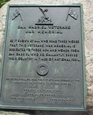
1. San Gabriel Veterans War Memorial Marker
Dedicated April 24, 1963, The Fiftieth Anniversary of the Incorporation of the City of San Gabriel. Dedication Committee: Mrs. Alick Barlow • Mrs. Amos Dubois • Mrs. Karl Lunt
Erected 1963 by Incorporation of the City of San Gabriel Dedication Committee.
Topics. This memorial is listed in this topic list: Military.
Location. 34° 5.879′ N, 118° 6.503′ W. Memorial is in San Gabriel, California, in Los Angeles County. It is on Mission Drive near Santa Anita Street, on the right when traveling north. Touch for map. Memorial is at or near this postal address: 320 S Mission Dr, San Gabriel CA 91776, United States of America. Touch for directions.

Regionally, this memorial is in Greater Los Angeles and in the Transverse Ranges. It is also on the American Pacific Coast. Globally, it is in North America, on the Ring of Fire, on the Pacific Rim, in the Western Hemisphere, in
this page online
Other nearby markers. At least 8 other markers are within walking distance of this marker: The Mission Playhouse (here, next to this marker); Grapevine Arbor (within shouting distance of this marker); La Casa Vieja de Lopez (within shouting distance of this marker); Ramona Museum of California History (within shouting distance of this marker); Early California (about 300 feet away, measured in a direct line); Bovard - Wilson - Hayes House and Jail (about 500 feet away); Chapman’s Mill and Millrace (about 600 feet away); Joseph Chapman’s Millrace (about 600 feet away). Touch for a list and map of all markers in San Gabriel.
Photographed by Denise Boose
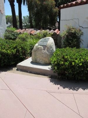
2. San Gabriel Veterans War Memorial Marker
Photographed by Denise Boose
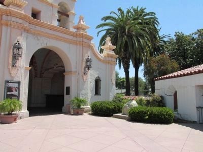
3. San Gabriel Veterans War Memorial
The marker is visible to the right of the entrance.
Credits. This page was last revised on January 30, 2023. It was originally submitted on July 8, 2013, by Denise Boose of Tehachapi, California. This page has been viewed 864 times since then and 32 times this year. Photos: 1, 2, 3. submitted on July 8, 2013, by Denise Boose of Tehachapi, California. • Syd Whittle was the editor who published this page.
