Mankato in Blue Earth County, Minnesota — The American Midwest (Upper Plains)
Washington Park
⎯⎯⎯
Fourth Street Route Depot Grounds
Photographed by K. Linzmeier, June 20, 2013
1. Washington Park Marker
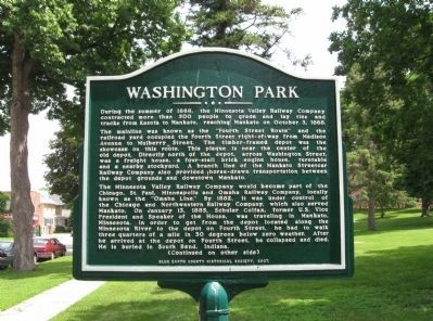
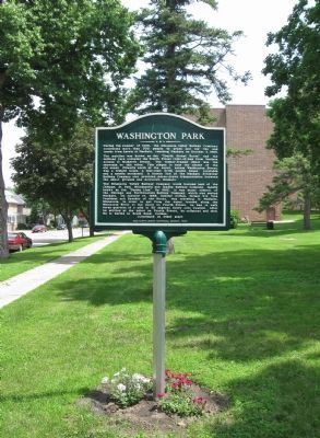
The mainline was known as the "Fourth Street Route" and the railroad yard occupied the Fourth Street right-of-way from Madison Avenue to Mulberry Street. The timber-framed depot was the showcase on this route. This plaque is near the center of the old depot. Directly north of the depot, across Washington Street, was a freight house, a four-stall brick engine house, turntable and a nearby stockyard. A branch line of the Mankato Streetcar Railway Company also provided horse-drawn transportation between the depot grounds and downtown Mankato.
The Minnesota Valley Railway Company would become part of the Chicago, St. Paul, Minneapolis and Omaha Railway Company, locally known as the "Omaha Line." By 1882, it was under control of the Chicago and Northwestern Railway Company, which also served Mankato. On January 13, 1885, Schuler Colfax, former U.S. Vice President and Speaker of the House, was traveling in Mankato, Minnesota.
this page online
Fourth Street Route Depot Grounds
(Continued from other side)
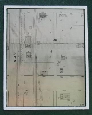
map
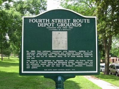
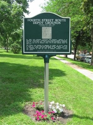
The Omaha Line decided to abandon its tracks on Fourth Street in favor of a route along the Minnesota River; however, they did not officially vacate the site until March 11, 1912. Washington Park was dedicated in 1915 by City of Mankato officials, citizens and guests.
Erected 2007 by Blue Earth County Historical Society.
Topics. This historical marker is listed in this topic list: Railroads & Streetcars. A significant historical date for this entry is January 13, 1885.
Location. 44° 10.072′ N, 93° 59.778′ W.
Photographed by K. Linzmeier, June 20, 2013
2. Fourth Street Route Depot Grounds Marker

Regionally, this marker is in Southwest Minnesota and specifically in the Minnesota River Valley. It is also in the American Midwest and in the Corn Belt. Globally, it is in North America, the Western Hemisphere, the Western World, and the Anglosphere. Historically, it finds itself in what was once Rupert’s Land and also the territory of the Mississippian Culture.
Other nearby markers. At least 8 other markers are within walking distance of this marker: Dakota (Sioux) Memorial – 1862 (approx. 0.3 miles away); Blue Earth County Courthouse (approx. 0.3 miles away); Korean War (approx. 0.3 miles away); Reconciliation Park (approx. 0.3 miles away); First Presbyterian Church (approx. 0.4 miles away); Reconciliation and Remembrance (approx. 0.4 miles away); Minnesota River Steamboating (approx. 0.4 miles away); Native Americans
Photographed by K. Linzmeier, June 20, 2013
3. Washington Park / Fourth Street Route Depot Grounds Marker
Photographed by K. Linzmeier, June 20, 2013
4. Washington Park / Fourth Street Route Depot Grounds Marker
Photographed by K. Linzmeier, June 20, 2013
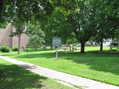
5. Washington Park / Fourth Street Route Depot Grounds and Marker
Photographed by K. Linzmeier, June 20, 2013
6. Close-up of Map
Credits. This page was last revised on October 21, 2020. It was originally submitted on July 11, 2013, by Keith L of Wisconsin Rapids, Wisconsin. This page has been viewed 1,416 times since then and 71 times this year. Photos: 1, 2, 3, 4, 5, 6. submitted on July 11, 2013, by Keith L of Wisconsin Rapids, Wisconsin.
