East in Lawrence in Marion County, Indiana — The American Midwest (Great Lakes)
Fort Benjamin Harrison
Indiana Historical Bureau
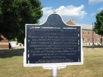
1. Fort Benjamin Harrison Marker
Erected 1996 by Indiana Historical Bureau and Fort Benjamin Harrison Historical Society. (Marker Number 49.1996.1.)
Topics and series. This historical marker is listed in this topic list: Forts and Castles. In addition, it is included in the Indiana Historical Bureau Markers series list. A significant historical year for this entry is 1903.
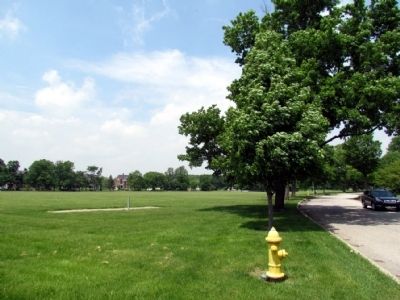
Location. Marker is missing. It was located near 39° 51.525′ N, 86° 0.835′ W. Marker was in Lawrence, Indiana, in Marion County. It was in East. It was on Lawton Loop E 0.2 miles north of Otis Ave, on the right when traveling south. Marker was located near the center east side of the former parade grounds of Fort Benjamin Harrison. Touch for map. Marker was in this post office area: Indianapolis IN 46236, United States of America. Touch for directions.

Regionally, this
this page online
Other nearby markers. At least 8 other markers are within 4 miles of this location, measured as the crow flies: Spring Valley Cemetery (approx. 0.2 miles away); Fort Harrison Terminal Station (approx. 0.2 miles away); Civilian Military Training Camp Latrines (approx. 0.3 miles away); The Citizen's Military Training Camp (CMTC) (approx. 0.3 miles away); a different marker also named The Citizen's Military Training Camp (CMTC) (approx. 0.4 miles away); Welcome to Camp Glenn (approx. 0.4 miles away); Return of the Natives (approx. one mile away); Ladywood Estates (approx. 3.8 miles away). Touch for a list and map of all markers in Lawrence.
Also see . . . Fort Benjamin Harrison. Wikipedia article. (Submitted on July 18, 2013, by Duane Hall of Abilene, Texas.)
Photographed by Duane Hall, May 20, 2013
2. Support Post for Fort Benjamin Harrison Marker
Photographed by Duane Hall, May 20, 2013
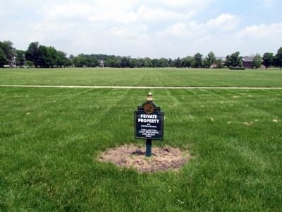
3. Former Parade Grounds of Fort Benjamin Harrison
Marker was located on the right (east) side of the parade grounds
Credits. This page was last revised on February 4, 2023. It was originally submitted on July 18, 2013, by Duane Hall of Abilene, Texas. This page has been viewed 1,022 times since then and 42 times this year. Photos: 1, 2, 3. submitted on July 18, 2013, by Duane Hall of Abilene, Texas. • Bill Pfingsten was the editor who published this page.
