Laurel in Franklin County, Indiana — The American Midwest (Great Lakes)
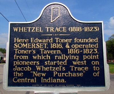
Whetzel Trace (1818-1823)
Erected 1965 by Society of Indiana Pioneers. (Marker Number 24.1965.1.)
Topics and series. This historical marker is listed in these topic lists: Roads & Vehicles • Settlements & Settlers. In addition, it is included in the Indiana Historical Bureau Markers series list. A significant historical year for this entry is 1816.
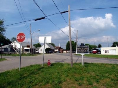
Location. 39° 29.943′ N, 85° 11.442′ W. Marker is in Laurel, Indiana, in Franklin County. Marker is at the intersection of Toner Street (State Road 121) and Main Street, on the left when traveling north on Toner Street. Touch for map. Marker is in this post office area: Laurel IN 47024, United States of America. Touch for directions.
Other nearby markers. At least 8 other markers are within 5 miles of this marker, measured as the crow flies. Brigadier General CSA Francis Asbury Shoup (approx. half a mile away); The Whitewater Canal Trail offers you: (approx. 1.1 miles away); Ben Franklin III (approx. 4.6 miles away); Passenger Pigeon Extinction (approx. 4.6 miles away); Methodist Episcopal Church (approx. 4.6 miles away); Metamora Grist Mill (approx. 4.6 miles away); Water Wheel & Lock #25 (approx. 4.6 miles away); Harnessing the Power of Water (approx. 4.6 miles away). Touch for a list and map of all markers in Laurel.
Also see . . .
1. IHB Review of Marker. The Indiana Historical Bureau in 2010 prepared a preliminary report on the marker regarding its accuracy and relevance. (Submitted on July 19, 2013, by Duane Hall of Abilene, Texas.)
2. Whetzel's Trace. "Fairfield - 200 Years" entry (Submitted on December 17, 2020, by Larry Gertner of New York, New York.)
Credits. This page was last revised on December 17, 2020. It was originally submitted on July 19, 2013, by Duane Hall of Abilene, Texas. This page has been viewed 454 times since then and 10 times this year. Photos: 1, 2. submitted on July 19, 2013, by Duane Hall of Abilene, Texas. • Bill Pfingsten was the editor who published this page.

