Laurel in Franklin County, Indiana — The American Midwest (Great Lakes)
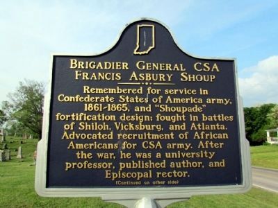
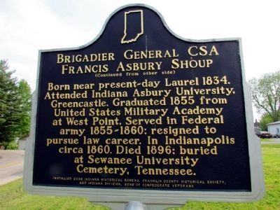
Brigadier General CSA Francis Asbury Shoup
Inscription.
(Front Side)
Remembered for service in Confederate States of America army, 1861-1865, and "Shoupade" fortification design; fought in battles of Shiloh, Vicksburg, and Atlanta. Advocated recruitment of African Americans for CSA army. After the war, he was a university professor, published author, and Episcopal rector.
(Back Side)
Born near present-day Laurel 1834. Attended Indiana Asbury University, Greencastle. Graduated 1855 from United States Military Academy at West Point. Served in Federal army 1855-1860; resigned to pursue law career. In Indianapolis circa 1860. Died 1896; buried at Sewanee University Cemetery, Tennessee.
Erected 2006 by Indiana Historical Bureau, Franklin County Historical Society, and Indiana Division, Sons of Confederate Veterans. (Marker Number 24.2006.1.)
Topics and series. This historical marker is listed in this topic list: War, US Civil. In addition, it is included in the Indiana Historical Bureau Markers, and the Sons of Confederate Veterans/United Confederate Veterans series lists. A significant historical year for this entry is 1834.
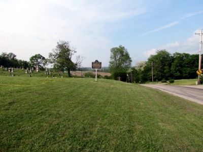
Location. 39° 30.259′ N, 85° 11.071′ W. Marker is in Laurel, Indiana, in Franklin County. Marker is at the intersection of State Road 121 and High Street, on the left when traveling north on State Road 121. Marker is adjacent to the Conwell Cemetery. Touch for map. Marker is in this post office area: Laurel IN 47024, United States of America. Touch for directions.
Other nearby markers. At least 8 other markers are within 5 miles of this marker, measured as the crow flies. Whetzel Trace (1818-1823) (approx. half a mile away); The Whitewater Canal Trail offers you: (approx. 1˝ miles away); Ben Franklin III (approx. 4.7 miles away); Methodist Episcopal Church (approx. 4.7 miles away); Passenger Pigeon Extinction (approx. 4.7 miles away); Metamora Grist Mill (approx. 4.7 miles away); Water Wheel & Lock #25 (approx. 4.7 miles away); Harnessing the Power of Water (approx. 4.7 miles away). Touch for a list and map of all markers in Laurel.
Also see . . . IHB Annotations. The Indiana Historical Bureau provides annotations for the text of the marker on their website. (Submitted on July 19, 2013, by Duane Hall of Abilene, Texas.)
Additional commentary.
1. Marker Replaced
The marker was damaged beyond repair by a vehicle in the summer of 2013. A new marker identical to the previous one was installed in May 2014 in the same location.
— Submitted June 22, 2014, by Duane Hall of Abilene, Texas.
Credits. This page was last revised on June 16, 2016. It was originally submitted on July 19, 2013, by Duane Hall of Abilene, Texas. This page has been viewed 780 times since then and 53 times this year. Photos: 1, 2, 3. submitted on July 19, 2013, by Duane Hall of Abilene, Texas. • Bill Pfingsten was the editor who published this page.


