Near Lander in Fremont County, Wyoming — The American West (Mountains)
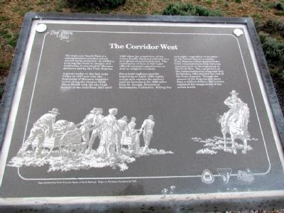
The Corridor West
A great exodus to the Salt Lake Valley in 1847 was only the beginning of Mormon emigrant travel along the Oregon Trail. About 68,000 took the the Utah branch of the trail from 1847 until 1869 when the completion of the Union Pacific Railroad ushered in a new phase of overland travel. The community of Zion at Salt Lake offered economic opportunity as well as religious freedom.
For a brief eighteen months beginning in April, 1860, eight young men carried the nation's mail on horseback for 1600 miles from St. Joseph, Missouri to Sacramento, California. Riding day and night - regardless of weather - on the fastest horses available, Pony Express riders maintained a vital communication link between east and west at the beginning of the Civil War. The completion of the transcontinental telegraph line in October, 1861 marked the end of the Pony Express. Though the owners of the Express lost more than a million dollars, the venture captured the imagination of the entire world.
Erected by Bureau of Land Management.
Topics and series. This historical marker is listed in these topic lists: Roads & Vehicles • Settlements & Settlers. In addition, it is included in the California Trail, the Mormon Pioneer Trail, the Oregon Trail, and the Pony Express National Historic Trail series lists. A significant historical month for this entry is April 1860.
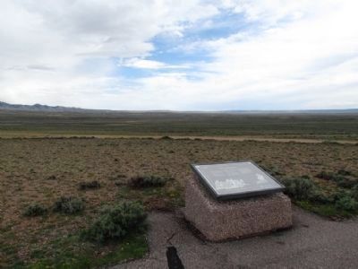
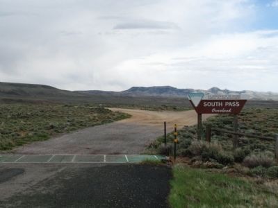
Location. 42° 19.804′ N, 108° 58.358′ W. Marker is near Lander, Wyoming, in Fremont County. Marker can be reached from State Highway 28, 0.7 miles south of Lander-Pinedale Stage Road. Marker is one of five interpretive signs at the South Pass Overlook. Touch for map. Marker is in this post office area: Lander WY 82520, United States of America. Touch for directions.
Other nearby markers. At least 8 other markers are within 5 miles of this marker, measured as the crow flies. The Way West (a few steps from this marker); South Pass (a few steps from this marker); a different marker also named South Pass (within shouting distance of this marker); Twin Mounds (within shouting distance of this marker); The Fur Trade (within shouting distance of this marker); Pacific Springs (approx. 1.4 miles away); Narcissa Prentiss Whitman (approx. 4˝ miles away); Old Oregon Trail (approx. 4˝ miles away). Touch for a list and map of all markers in Lander.
More about this marker. Sign donated by First Security Bank of Rock Springs; Roger A. Weidner, President & CEO.
Also see . . . South Pass - Wikipedia entry. (Submitted on July 25, 2013, by Duane Hall of Abilene, Texas.)
Credits. This page was last revised on June 16, 2016. It was originally submitted on July 25, 2013, by Duane Hall of Abilene, Texas. This page has been viewed 664 times since then and 26 times this year. Photos: 1, 2, 3, 4. submitted on July 25, 2013, by Duane Hall of Abilene, Texas. • Syd Whittle was the editor who published this page.


