Near McGill in White Pine County, Nevada — The American Mountains (Southwest)
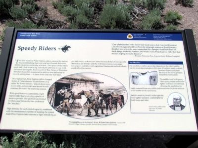
Speedy Riders
On a typical run, Pony Express riders changed horses at "relay stations" located every 12-15 miles. At "home stations," spaced about every 75-100 miles, a fresh rider and mount would continue the run to the next relay station.
With speed however, came limits. Each express rider had a carrying capacity of about 10 pounds. The payload was limited to what could fit into the four pockets of the "mochila."
High demand for such limited capacity, combined with the monumental express of funding the system made Pony Express rates extremely high: initially $5.00 per half ounce, or $1,000 per ounce in 2002 dollars. Consequently, other than the military and the U.S. Government, only major newspapers and other well-capitalized businesses and individuals could afford the service.
The Mochila
The mochila, a leather apron that slipped over the rider's saddle, was the most important piece of his gear. It had four small, lockable pouches that securely held the mail as the horse galloped toward the next station.
The saddles used by Express riders were custom made to be lighter and more streamlined, allowing the mochila to be easily removed from one saddle and tossed over the horn and seat of the saddle on the next horse.
Saddles made by Israel Landis typically were lighter and more comfortable for both horse and rider.
Israel Landis, saddle maker 1840-1900, St. Joseph, Missouri
(Drawing Caption)
"Changing Horses at the Station" Artist, William Henry Jackson. Courtesy of the Howard R. Driggs Collection, Gerald R. Sherratt Library, Southern Utah University.
Erected by National Pony Express Association, Bureau of Land Management, National Park Service, U.S. Department of the Interior.
Topics and series. This historical marker is listed in these topic lists: Communications • Roads & Vehicles. In addition, it is included in the Pony Express National Historic Trail series list. A significant historical year for this entry is 2002.
Location. 39° 47.845′ N, 114° 44.447′ W. Marker is near McGill, Nevada, in White Pine County. Marker can be reached from the intersection of U.S. 93 and White Pine County Road 18 (Nevada Route 893), on the right when traveling north. Marker is located at the Schellbourne Rest Area. Touch for map. Marker is in this post office area: Mc Gill NV 89318, United States of America. Touch for directions.
Other nearby markers. At least 8 other markers are within 11 miles of this marker, measured as the crow flies. The Crowds Cheered On ... (here, next to this marker); Strength and Endurance (here, next to this marker); The Pony Express (a few steps from this marker); The Lincoln Highway (a few steps from this marker); Schellbourne: Gateway to the Goshute Nation (within shouting distance of this marker); Schellbourne (within shouting distance of this marker); Cherry Creek (approx. 10˝ miles away); Cherry Creek School (approx. 10.6 miles away). Touch for a list and map of all markers in McGill.
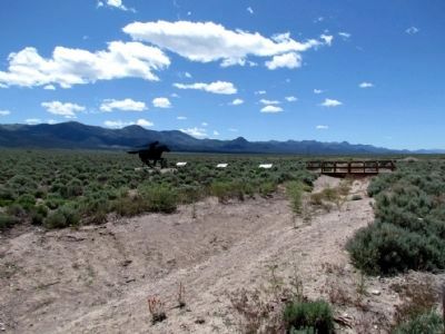
More about this marker. Marker is one of three Pony Express National Trail interpretive signs for the Schell Creek Station.
Credits. This page was last revised on June 16, 2016. It was originally submitted on July 29, 2013, by Duane Hall of Abilene, Texas. This page has been viewed 418 times since then and 19 times this year. Photos: 1, 2. submitted on July 29, 2013, by Duane Hall of Abilene, Texas. • Syd Whittle was the editor who published this page.

