Near McGill in White Pine County, Nevada — The American Mountains (Southwest)
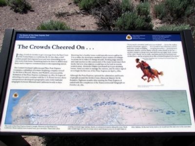
The Crowds Cheered On ...
The Central Overland California and Pikes Peak Express Company, a subsidiary of a major freighting company owned by the firm of Russell, Majors, and Waddell, announced the formation of the Pony Express on January 27, 1860. In hopes of attracting a lucrative contract with the U.S. Postal Service, these entrepreneurs developed a proposal to carry letter mail and telegraphs between Missouri and California in only 10 days.
Knowing that a healthy horse could typically run at a gallop for 8 to 12 miles, the developers needed to place stations at strategic locations for its riders to change mounts. Existing stage stations and road ranches on the eastern end of the route would meet their needs, but new relay stations would have to be built in remote western areas. Alexander Majors purchased up to 500 mustang horses, hired 200 men to manage the stations, and 80 riders signed on to begin the first run of the Pony Express on April 3, 1860.
Although the Pony Express captured the admiration and hearts of people around the world, it was a financial disaster for its founders. Eighteen months after starting the Pony Express, it ended with the completion of the Transcontinental Telegraph on October 26, 1861.
"Every neck is stretched, and every eye strained ... Across the endless prairie a black spec appears ... In a second or two it becomes a horse and rider, rising and falling ... sweeping toward us--growing more and more distinct, and the flutter of hoofs comes faintly to the ear--another instant a whoop and a hurrah from our upper deck, a wave of the rider's hand, but no reply, and man and horse burst past our excited faces, and go winging away like a belated fragment of a storm."—Mark Twin, Roughing It, 1872. Traveling on the Overland Stage in the summer of 1861
(Drawing Caption)
Charles Hargen's "First Ride of the Pony Express"—Pony Express National Museum, St. Joseph, Missouri.
(Map Caption)
The route of the Pony Express from St. Joseph, Missouri, to San Francisco, California. Home stations were located every 75 to 100 miles. These were often existing overland stage stations, hotels, or substantial ranches along the route. Each rider would begin his run at a home station and change horses six or eight times at relay stations. At the next home station, he would turn the mail over to the next rider.
Erected by National Pony Express Association, Bureau of Land Management, National Park Service, U.S. Department of the Interior.
Topics and series. This historical marker is listed in these topic lists: Communications • Roads & Vehicles. In addition, it is included in the Pony Express National Historic Trail series list. A significant historical month for this entry is January 2002.
Location. 39° 47.845′ N, 114° 44.451′ W. Marker is near McGill, Nevada, in White Pine County. Marker can be reached from the intersection of U.S. 93 and White Pine County Road 18 (Nevada Route 893), on the right when traveling north. Marker is located at the Schellbourne Rest Area. Touch for map. Marker is in this post office area: Mc Gill NV 89318, United States of America. Touch for directions.
Other nearby markers. At least 8 other markers are within 11 miles of this marker, measured as the crow flies. Speedy Riders (here, next to this marker); Strength and Endurance (a few steps from this marker); The Pony Express (a few steps from this marker); The Lincoln Highway (a few steps from this marker); Schellbourne: Gateway to the Goshute Nation (a few steps from this marker); Schellbourne (within shouting distance of this marker); Cherry Creek (approx. 10˝ miles away); Cherry Creek School (approx. 10.6 miles away). Touch for a list and map of all markers in McGill.
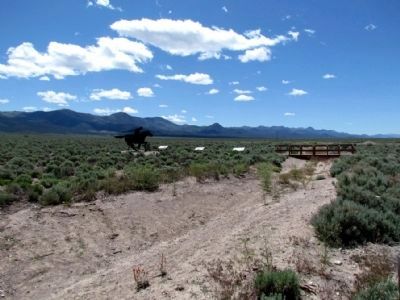
More about this marker. Marker is one of three Pony Express National Trail interpretive signs for the Schell Creek Station.
Credits. This page was last revised on June 16, 2016. It was originally submitted on July 29, 2013, by Duane Hall of Abilene, Texas. This page has been viewed 418 times since then and 16 times this year. Photos: 1, 2. submitted on July 29, 2013, by Duane Hall of Abilene, Texas. • Syd Whittle was the editor who published this page.

