Downtown Harrisburg in Dauphin County, Pennsylvania — The American Northeast (Mid-Atlantic)
St. Michael’s Lutheran Church
Photographed by William Pfingsten, March 21, 2008
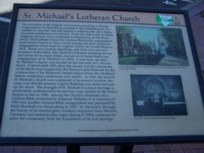
1. St. Michael's Lutheran Church Marker
this page online
Top Photo
Circa 1910 postcard view with St. Michael's at far left looking up State Street toward the Capitol.
Bottom Photo
Pre-1926 interior view of church sanctuary.
Erected by The Harrisburg History Project Commissioned by Mayor Stephen R. Reed.
Topics and series. This historical marker is listed in these topic lists: Architecture • Railroads & Streetcars • Religion & Religious Structures. In addition, it is included in the Pennsylvania Railroad (PRR), and the Pennsylvania, The Harrisburg History Project series lists. A significant historical year for this entry is 1822.
Location. 40° 15.751′ N,
Photographed by William Pfingsten, March 21, 2008
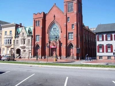
2. St. Michael Lutheran Church

Regionally, this marker is in South-Central Pennsylvania, specifically in Pennsylvania Dutch Country, and in the Susquehanna Valley. It is also in the American Northeast and in the Mid-Atlantic. Globally, it is in North America, the Western Hemisphere, the Western World, and the Anglosphere. Historically, it finds itself in what was once the Haudenosaunee (Iroquois) Confederacy and also one of the original Thirteen Colonies.
Other nearby markers. At least 8 other markers are within walking distance of this marker: Parish Church of St. Lawrence (Former) (here, next to this marker); J. Donald Cameron (within shouting distance of this marker); J. Donald Cameron Mansion (within shouting distance of this marker); William Maclay Mansion (within shouting distance of this marker);
Photographed by John K. Robinson, May 11, 2008
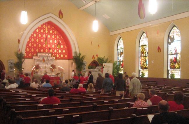
3. Interior of St. Michael Lutheran Church
Regarding St. Michael’s Lutheran Church. The correct name of the church is “St. Michael Lutheran Church,” not “St. Michael’s.” This was changed many years ago.
Photographed by John K. Robinson, September 26, 2007
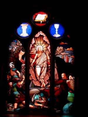
4. Resurrection Window
This stained glass window was brought to the current church building (1906) from the congregation's earlier building on South Second Street near Washington Street.
Credits. This page was last revised on December 5, 2019. It was originally submitted on March 29, 2008, by Bill Pfingsten of Bel Air, Maryland. This page has been viewed 2,919 times since then and 85 times this year. Photos: 1, 2. submitted on March 29, 2008, by Bill Pfingsten of Bel Air, Maryland. 3, 4. submitted on May 17, 2008, by John K. Robinson of Harrisburg, Pennsylvania.
