Chillicothe in Livingston County, Missouri — The American Midwest (Upper Plains)
History of the NW Corner of Washington and Clay Streets
Inscription.
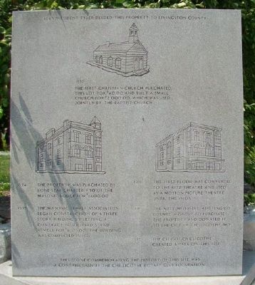
1843 • President Tyler deeded this property to Livingston County
1857 • The First Christian Church purchased this lot for $40.00 and built a small church for $2,000.00 which was used jointly by the Baptist Church.
1894 • The property was purchased by Lone Star Chapter #30 of the Masonic Lodge for $1,600.00
1895 • The Masonic Temple Association began construction of a three story building by letting a contract to Richard's [sic] and Atwell for $11,975.00. The building was completed in 1896.
1931 • The first floor was converted to the Ritz Theatre and used as a motion picture theatre until the 1960's.
1996 • The Watt Mizer Distributing Co. formed a group to purchase the property and donated it to the City of Chillicothe, Mo.
1997 • The City of Chillicothe created a park on this site.
This stone commemorating the history of this site was a contribution by the Chillicothe Rotary Club Foundation.
Erected by Chillicothe Rotary Club Foundation.
Topics and series. This historical marker is listed in these topic lists: Entertainment • Fraternal or Sororal Organizations • Settlements & Settlers . In addition, it is included in the Former U.S. Presidents: #10 John Tyler, and the Rotary International series lists. A significant historical year for this entry is 1843.
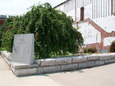
Location. 39° 47.556′ N, 93° 33.231′ W. Marker is in Chillicothe, Missouri, in Livingston County. Marker is at the intersection of Washington Street (U.S. 65) and Clay Street, on the left when traveling north on Washington Street. Touch for map. Marker is in this post office area: Chillicothe MO 64601, United States of America. Touch for directions.
Other nearby markers. At least 8 other markers are within walking distance of this marker. Graham's Mill & Bridge (a few steps from this marker); Loomis Building (within shouting distance of this marker); Veterans Memorial (about 400 feet away, measured in a direct line); a different marker also named Veterans Memorial (about 400 feet away); Citizens Bank & Trust (about 400 feet away); 608-612 Washington Street (about 500 feet away); Livingston County Courthouse Historic Districts (about 500 feet away); 601-605 Locust Street (about 500 feet away). Touch for a list and map of all markers in Chillicothe.
Credits. This page was last revised on February 16, 2022. It was originally submitted on August 4, 2013, by William Fischer, Jr. of Scranton, Pennsylvania. This page has been viewed 403 times since then and 8 times this year. Photos: 1, 2. submitted on August 4, 2013, by William Fischer, Jr. of Scranton, Pennsylvania.

