Atwater in Portage County, Ohio — The American Midwest (Great Lakes)
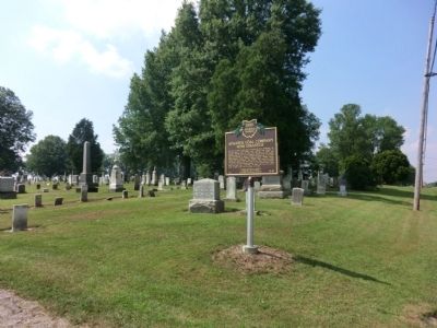
Atwater Coal Company Mine Disaster
On July 3, 1872, 16 men and a 9-year old boy descended the 170 foot shaft in the Atwater Coal Company Mine located in Atwater Township south of Route 224 and East of Route 225. The mine was situated on the property known as the S.G. Shaffer Farm. By mid-day, 7 miners survived the brutal fire in the mine. Richard Roberts, Robert Roberts, William Roberts, Thomas Maines, Joseph Otey, John Williams, John Howells, John Jones and a 9-year old George Hufford gave their lives to the first Mining Disaster in Ohio and the 19th mining disaster in the United States since 1839 with more than 5 fatalities. In 1873, Ohio was second State to pass a law for the safety of Miners.
Erected 2011 by Atwater Historical Society-Residents of Atwater-The Ohio Historical Society. (Marker Number 13-67.)
Topics and series. This historical marker is listed in this topic list: Disasters. In addition, it is included in the Ohio Historical Society / The Ohio History Connection series list. A significant historical month for this entry is July 1844.
Location. 41° 1.15′ N, 81° 8.883′ W. Marker is in Atwater, Ohio, in Portage County. Marker is on Atwater Road (Ohio Route 183) south of Waterloo Road (U.S. 224), on the right when traveling south. The marker is located near the entrance to Atwater Cemetery. Touch for map. Marker is in this post office area: Atwater OH 44201, United States of America. Touch for directions.
Other nearby markers. At least 8 other markers are within 7 miles of this marker, measured as the crow flies. Deer Creek Quaker Cemetery (approx. 2˝ miles away); Lexington Quaker Cemetery (approx. 4.4 miles away); Marlborough Quaker Burying Grounds & Meeting House (approx. 5.6 miles away); Spanish American War Veterans (approx. 6.2 miles away); The Deceased of Co. F. 115th Ohio Volunteer Infantry (approx. 6.4 miles away); The Sultana Tragedy (approx. 6.4 miles away); Mabel Hartzell (approx. 6.6 miles away); Alliance-Birthplace of Ohio's State Flower - The Scarlet Carnation (approx. 7.1 miles away).
Credits. This page was last revised on May 22, 2022. It was originally submitted on August 9, 2013, by Don Morfe of Baltimore, Maryland. This page has been viewed 3,080 times since then and 247 times this year. Photos: 1, 2. submitted on August 9, 2013, by Don Morfe of Baltimore, Maryland. • Al Wolf was the editor who published this page.

