Near Elko in Elko County, Nevada — The American Mountains (Southwest)
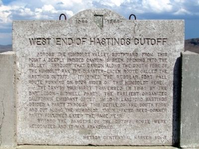
West End of Hastings Cutoff
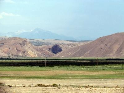
Across the Humboldt Valley southward from this point a deeply incised canyon is seen opening into the valley. Through that canyon along the South Fork of the Humboldt ran the disaster-laden route called the Hastings Cutoff. It joined the regular Fort Hall route running on both sides of the Humboldt here.
The canyon was first traversed in 1841 by the Bartleson-Bidwell party, the earliest organized California emigrant group. In 1846 Lansford Hastings guided a party through this defile of the South fork and out along the Humboldt. The ill-fated Reed-Donner party followed later the same year.
By 1850 the dangers of the cutoff route were recognized and it was abandoned.
Erected 1964. (Marker Number 3.)
Topics and series. This historical marker is listed in these topic lists: Roads & Vehicles • Settlements & Settlers. In addition, it is included in the California Trail series list. A significant historical year for this entry is 1841.
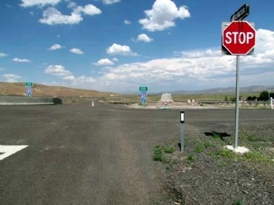
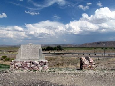
Location. 40° 45.965′ N, 115° 55.184′ W. Marker is near Elko, Nevada, in Elko County. Marker can be reached from Interstate 80 at milepost 292, on the right when traveling east. Marker is located at the entrance to the eastbound on-ramp of Exit 292 (Hunter). Touch for map. Marker is in this post office area: Elko NV 89801, United States of America. Touch for directions.
Other nearby markers. At least 8 other markers are within 6 miles of this marker, measured as the crow flies. Hoppe-Lienhard Wagon Group (here, next to this marker); Marking Time (approx. 0.2 miles away); California Trail - Greenhorn Cutoff (approx. 0.2 miles away); About Your Journey ... (approx. 0.2 miles away); The End of the Hastings Cutoff (approx. 0.2 miles away); The Humboldt River Highway (approx. 0.2 miles away); The California Emigrant Trail Interpretive Center (approx. 0.2 miles away); California Trail - Carlin Canyon (approx. 5.4 miles away). Touch for a list and map of all markers in Elko.
More about this marker. The marker is Nevada Centennial Marker No. 3, installed in 1964 as part of Nevada's celebration of its 100th anniversary of statehood and the beginning of the Nevada Historical Marker Program.
Also see . . .
1. California Trail Interpretive Center Website. (Submitted on August 9, 2013, by Duane Hall of Abilene, Texas.)
2. New Amended Text for Marker. The Nevada State Historic Preservation Office (SHPO) recently updated the text of the roughly 260 state historical markers in Nevada. The Nevada SHPO placed the amended text of each individual marker on its website and will change the actual markers in the field as funding allows. Minor changes have been made to the
marker for grammar and readability. The link will take you to the Nevada SHPO page for the marker with the amended text. (Submitted on November 12, 2013, by Duane Hall of Abilene, Texas.)
Credits. This page was last revised on May 16, 2020. It was originally submitted on August 9, 2013, by Duane Hall of Abilene, Texas. This page has been viewed 696 times since then and 33 times this year. Photos: 1, 2, 3, 4. submitted on August 9, 2013, by Duane Hall of Abilene, Texas.


