Near Windsor in Bertie County, North Carolina — The American South (South Atlantic)
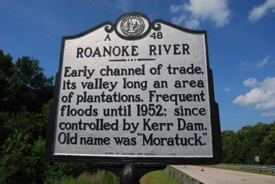
Roanoke River
Erected 1973 by North Carolina Office of Archives and History. (Marker Number A-48.)
Topics and series. This historical marker is listed in this topic list: Waterways & Vessels. In addition, it is included in the North Carolina Division of Archives and History series list. A significant historical year for this entry is 1952.
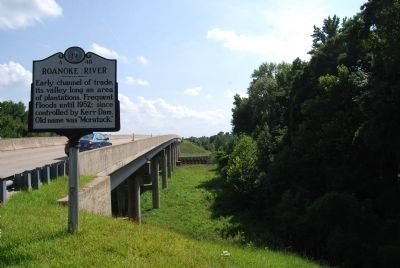
Location. 35° 51.636′ N, 77° 2.374′ W. Marker is near Windsor, North Carolina, in Bertie County. Marker is on East Boulevard (U.S. 17/13) 0.8 miles north of East Main Street, on the right when traveling south. Touch for map. Marker is in this post office area: Windsor NC 27983, United States of America. Touch for directions.
Other nearby markers. At least 8 other markers are within 2 miles of this marker, measured as the crow flies. Camp Williamston (approx. 0.2 miles away); Freedom Rallies (approx. 0.6 miles away); Martin County Veterans Memorial (approx. ¾ mile away); Martin County Courthouse (approx. 0.8 miles away); Asa Biggs (approx. 0.9 miles away); Asa Biggs House (approx. one mile away); Memorial Baptist Church (approx. one mile away); Skewarkee Primitive Baptist Church (approx. 2 miles away).
More about this marker. There is another marker on the south end of the bridge, could not take picture due to high traffic flow.
Credits. This page was last revised on June 16, 2016. It was originally submitted on August 11, 2013, by Mike Wintermantel of Pittsburgh, Pennsylvania. This page has been viewed 571 times since then and 22 times this year. Photos: 1, 2. submitted on August 11, 2013, by Mike Wintermantel of Pittsburgh, Pennsylvania.
Editor’s want-list for this marker. photo of Southbound south end of bridge marker • Can you help?

