Coalville in Summit County, Utah — The American Mountains (Southwest)
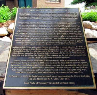
The Founding of Coalville City
About the time William H. smith was discovering wheat growing the Chalk Creek area, Thomas Rhoades, a roving hunter and trapper discovered outcroppings of coal. He had gone up on a high knoll at what is now known as Skunk's Point, to scan the countryside for game. He dug out samples of coal with his knife; he took them to Salt Lake City, and presented them to the Mormon Prophet Brigham Young. Brigham Young had offered an award of $1,000 to any one finding coal within 50 miles of Salt Lake City. Nothing seemed to have been done about it until in 1860 Brigham Young sent John Muir and Sam Fletcher out to investigate the discovery. They were camped in a large Hawthorne patch at the forks in the Canyon of Chalk Creek. While dressing in the morning, Flectcher saw a deer. He shot it, but only wounded it. Not wanting to lose it, he called to Muir t help him trail it. They trailed it over into Grass Creek, and came upon a ledge to rock standing higher than the surrounding country. Underneath the rock was a vein of coal ten feet thick. This mine was opened on what is known as Lion's hill by Daniel H. Wells, Bryant Stringham and Stephen Taylor. It was called Old Church Mine.
Joel Lewis, H.B. Wilde, and Andrew Johnson were the first to open a mine near Coalville in what is now known as Allen Hollow. Andrew Johnson also opened up a mine at the head of Spring Hollow. The first mine operated in Spring Hollow was called the Black Diamond Mine. Another was called the Wasatch. Andrew Johnson sold the mine to W.H. Smith who later sold it to the Weber Coal Company. This company ran the coal mine for many years and furnished work for many Coalville residents.
Farmers would work on their farms in the summer and work in the Wasatch or Grass Creek mines during the winter. In 1868 about the time the Allen Hollow mine was opened, three others were being opened. John Spriggs opened one that ran under the school house hill and under the town. That mine was abandoned, although relatives still own the Coal. John Booth opened a mine in Dexter's Hollow south of town. During the early days, hundreds of tons of coal were hauled mostly by ox teams to Salt Lake City.
On January 16, 1867, the Legislature approved an act incorporating the City of Coalville.
The first mayor was W.W. Cluff, 1867-1871.
From "Echo of Yesterday" (Compiled by Nellie Frost)
Topics. This historical marker is listed in these topic lists: Industry & Commerce • Settlements & Settlers. A significant historical month for this entry is January 1904.
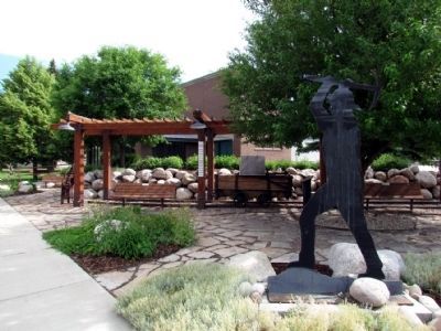
Location. 40° 55.002′ N, 111° 23.906′ W. Marker is in Coalville, Utah, in Summit County. Marker is at the intersection of N. Main Street and Center Street, on the right when traveling north on N. Main Street. Marker is located next to Coalville City Hall. Touch for map. Marker is at or near this postal address: 10 N Main Street, Coalville UT 84017, United States of America. Touch for directions.
Other nearby markers. At least 7 other markers are within 9 miles of this marker, measured as the crow flies. Old Rock School House (approx. 0.2 miles away); Old Fort and Hoyt Grist Mill (approx. 3.1 miles away); The Road to Zion (approx. 5.1 miles away); Echo Canyon (approx. 5.1 miles away); Welcome to Echo Canyon (approx. 5.1 miles away); Wanship Station (approx. 6.9 miles away); "Mormon" Pioneer Trail (approx. 8.8 miles away).
Credits. This page was last revised on August 2, 2020. It was originally submitted on August 13, 2013, by Duane Hall of Abilene, Texas. This page has been viewed 663 times since then and 31 times this year. Photos: 1, 2. submitted on August 13, 2013, by Duane Hall of Abilene, Texas.

