Falmouth in Pendleton County, Kentucky — The American South (East South Central)
Bell
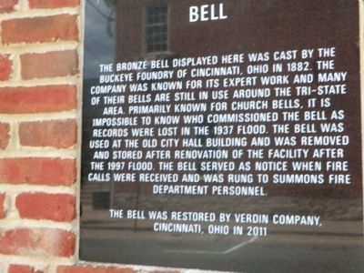
Photographed by Don Morfe, July 20, 2013
1. Bell Marker
Topics and series. This historical marker is listed in this topic list: Landmarks. In addition, it is included in the Historic Bells series list. A significant historical year for this entry is 1882.
Location. 38° 40.6′ N, 84° 19.8′ W. Marker is in Falmouth, Kentucky, in Pendleton County. It is at the intersection of Main St. and East Shelby Street, on the right when traveling north on Main St.. Touch for map. Marker is in this post office area: Falmouth KY 41040, United States of America. Touch for directions.

Regionally, this marker is in the Outer Bluegrass. It is
this page online
Other nearby markers. At least 8 other markers are within 11 miles of this marker, measured as the crow flies: Virgilene Ritter Moore • Walter B. Moore (a few steps from this marker); The Kennett Tavern (within shouting distance of this marker); County Named 1798 (within shouting distance of this marker); Bird’s War Road (about 500 feet away, measured in a direct line); Albert A. Jameson (approx. 0.2 miles away); John Waller (approx. 4 miles away); British Indian Raid (approx. 6.1 miles away); Bold House (approx. 10.6 miles away). Touch for a list and map of all markers in Falmouth.
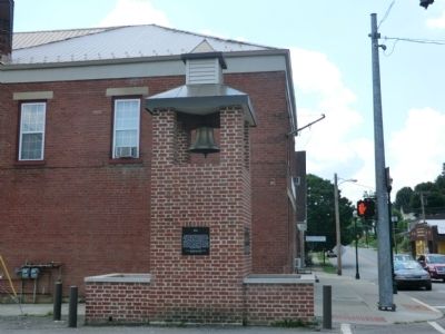
Photographed by Don Morfe, July 20, 2013
2. Bell Marker
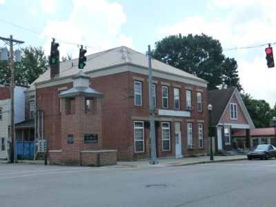
Photographed by Don Morfe, July 20, 2013
3. Bell Marker
Credits. This page was last revised on June 16, 2016. It was originally submitted on August 15, 2013, by Don Morfe of Baltimore, Maryland. This page has been viewed 711 times since then and 27 times this year. Photos: 1, 2, 3. submitted on August 15, 2013, by Don Morfe of Baltimore, Maryland. • Al Wolf was the editor who published this page.
