Gainesville in Alachua County, Florida — The American South (South Atlantic)
Serenola Plantation
Photographed by Tim Fillmon, February 3, 2013
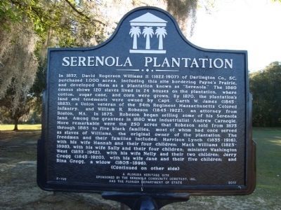
1. Serenola Plantation Marker (side 1)
Inscription.
Serenola Plantation. . (side 1) , In 1857, David Rogerson Williams II (1822-1907) of Darlington Co., SC, purchased 1,000 acres, including this site bordering Paynes Prarie, and developed them as a plantation known as "Serenola." The 1860 census shows 120 slaves lived in 24 houses on the plantation, where cotton, sugar cane, and corn were grown. By 1870, the plantation's land and tenements were owned by Capt. Garth W. James (1845-1883), a Union veteran of the 54th Regiment Massachusetts Colored Infantry, and William R. Robeson (1845-1922), an attorney from Boston, MA. In 1875, Robeson began selling some of his Serenola land. Among the grantees in 1880 was industrialist Andrew Carnegie. More remarkable were the 250 acres that Robeson sold from 1875 through 1885 to five black families, most of whom had once served as slaves of Williams, the original owner of the plantation. The freedmen and their families included: Harrison Lynch (1835-1916), with his wife Hannah and their four children; Mack Williams (1825-1898), with his wife Sally and their four children; minister Washington West (1853-1942),with his wife Nelly and their two children; Jerry Gregg (1845-1920), with his wife Jane and their five children; and Bina Gregg, a widow (1805-1896).
(Continued on other side). (side 2) ,
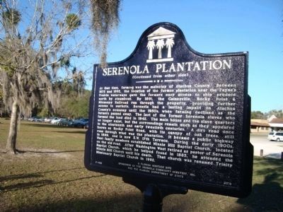
(Continued from other side). At that time, farming was the mainstay of Alachua County. Between 1872 and 1892, the location of the former plantation near the Paynes Prarie waterways gave the farmers easy access to ship produce north by steamboat. By 1891, the Gainesville, Rocky Point and Micanopy Railroad ran through the property, providing further access to markets. Serenola had a lasting impact on Alachua County's economy until the 1950s, when farming declined as the farmers passed away. The last of the former Serenola slaves who farmed the land died in 1942. The main house and the slave quarters no longer exist, but the surroundings remain much as they appeared in the nineteenth and early twentieth centuries. A dirt road once known as Rocky Point Road, with its canopy of oak trees, still runs through what was the plantation. It became a public highway in 1889, and is now SW 17th Terrace. During the early 1900s, West family members established Minnie Hill Baptist Church, located on the old road. After Washington West retired as pastor of Serenola Baptist Church, which he helped found in 1885, he attended the Minnie Hill Baptist Church until his death. That church was renamed Trinity Missionary Baptist Church in 1992.
(side 1)
In 1857, David Rogerson Williams II (1822-1907) of Darlington Co., SC, purchased 1,000 acres, including this site bordering Paynes Prarie, and developed them as a plantation known as "Serenola." The 1860 census shows 120 slaves lived in 24 houses on the plantation, where cotton, sugar cane, and corn were grown. By 1870, the plantation's land and tenements were owned by Capt. Garth W. James (1845-1883), a Union veteran of the 54th Regiment Massachusetts Colored Infantry, and William R. Robeson (1845-1922), an attorney from Boston, MA. In 1875, Robeson began selling some of his Serenola land. Among the grantees in 1880 was industrialist Andrew Carnegie. More remarkable were the 250 acres that Robeson sold from 1875 through 1885 to five black families, most of whom had once served as slaves of Williams, the original owner of the plantation. The freedmen and their families included: Harrison Lynch (1835-1916), with his wife Hannah and their four children; Mack Williams (1825-1898), with his wife Sally and their four children; minister Washington West (1853-1942),with his wife Nelly and their two children; Jerry Gregg
Click or scan to see this page online
(1845-1920), with his wife Jane and their five children; and Bina Gregg, a widow (1805-1896).
(Continued on other side)
(side 2)
(Continued from other side)
At that time, farming was the mainstay of Alachua County. Between 1872 and 1892, the location of the former plantation near the Paynes Prarie waterways gave the farmers easy access to ship produce north by steamboat. By 1891, the Gainesville, Rocky Point & Micanopy Railroad ran through the property, providing further access to markets. Serenola had a lasting impact on Alachua County's economy until the 1950s, when farming declined as the farmers passed away. The last of the former Serenola slaves who farmed the land died in 1942. The main house and the slave quarters no longer exist, but the surroundings remain much as they appeared in the nineteenth and early twentieth centuries. A dirt road once known as Rocky Point Road, with its canopy of oak trees, still runs through what was the plantation. It became a public highway in 1889, and is now SW 17th Terrace. During the early 1900s, West family members established Minnie Hill Baptist Church, located on the old road. After
Photographed by Tim Fillmon, February 3, 2013
2. Serenola Plantation Marker (side 2)
Washington West retired as pastor of Serenola Baptist Church, which he helped found in 1885, he attended the Minnie Hill Baptist Church until his death. That church was renamed Trinity Missionary Baptist Church in 1992.
Erected 2010 by The Serenola Community Cemetery, Inc. and the Florida Department of State. (Marker Number F-705.)
Location. 29° 36.794′ N, 82° 20.605′ W. Marker is in Gainesville, Florida, in Alachua County. It can be reached from SW Williston Road (State Road 331) 0.1 miles west of SW 13th Street (U.S. 441). Located in Squirrel Ridge Park near parking area. Touch for map. Marker is at or near this postal address: 1603 SW Williston Road, Gainesville FL 32608, United States of America. Touch for directions.
Regionally, this marker is in North Florida. It is also in the American South. Globally, it is in the North Atlantic Region, North America, a Gulf of Mexico state, the Western Hemisphere, the Western World, and the Anglosphere.
Photographed by Tim Fillmon, November 18, 2021
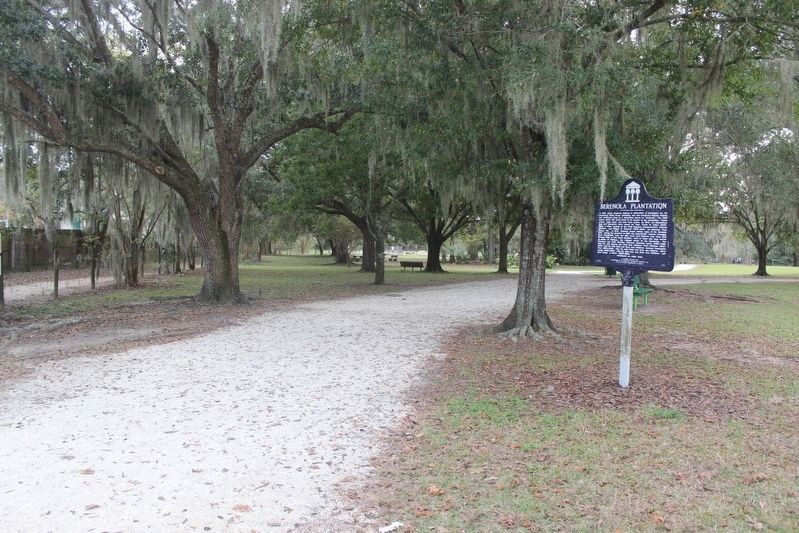
3. Serenola Plantation Marker
Historically, it finds itself in what was once New Spain, the territory of the Mississippian Culture, one of the Confederate States of America, and the Antebellum South.
Credits. This page was last revised on November 19, 2021. It was originally submitted on August 15, 2013, by Tim Fillmon of Webster, Florida. This page has been viewed 2,571 times since then and 144 times this year. Photos:1, 2. submitted on August 15, 2013, by Tim Fillmon of Webster, Florida. 3. submitted on November 19, 2021, by Tim Fillmon of Webster, Florida. • Bernard Fisher was the editor who published this page.