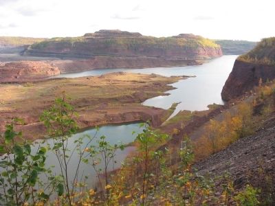
Kelly Lake near Hibbing in Saint Louis County, Minnesota — The American Midwest (Upper Plains)
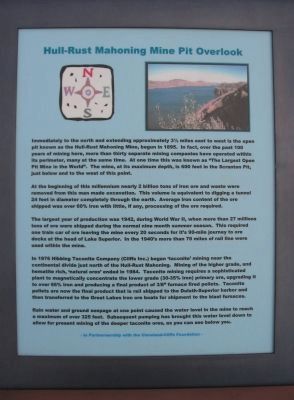
Hull-Rust Mahoning Mine Pit Overlook
At the beginning of this millennium nearly 2 billion tons of iron ore and waste were removed from this man made excavation. This volume is equivalent to digging a tunnel 24 feet in diameter completely through the earth. Average iron content of the ore shipped was over 60% iron with little, if any, processing of the ore required.
The largest year of production was 1942, during World War II, when more than 27 millions tons of ore were shipped during the normal nine month summer season. This required one train car of ore leaving the mine every 20 seconds for it's 90-mile journey to ore docks at the head of Lake Superior. In the 1940's more than 70 miles of rail line were used within the mine.
In 1976 Hibbing Taconite Company (Cliffs Inc.) began 'taconite' mining near the continental divide just north of the Hull-Rust Mahoning. Mining of the higher grade, and hematite rich, 'natural ores' ended in 1984. Taconite mining requires a sophisticated plant to magnetically concentrate the lower grade (30-35% iron) primary ore, upgrading it to over 66% iron and producing a final product of 3/8" furnace fired pellets. Taconite pellets are now the final product that is rail shipped to the Duluth-Superior harbor and then transferred to the Great Lakes iron ore boats for shipment to the blast furnaces.
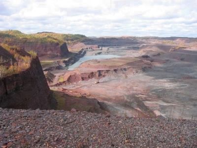
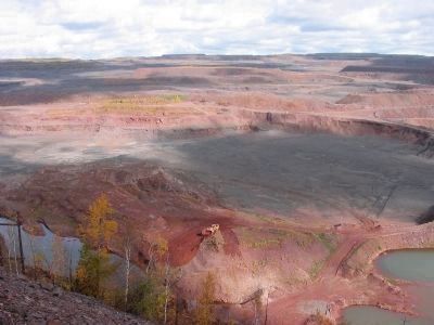
Rain water and ground seepage at one point caused the water level in the mine to reach a maximum of over 325 feet. Subsequent pumping has brought this water level down to allow for present mining of the deeper taconite ores, as you can see below you.
Topics. This historical marker is listed in these topic lists: Industry & Commerce • War, World II. A significant historical year for this entry is 1895.
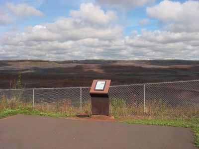
Location. 47° 26.854′ N, 92° 56.755′ W. Marker is near Hibbing, Minnesota, in Saint Louis County. It is in Kelly Lake. Marker can be reached from Greyhound Boulevard/3rd Avenue East, on the left when traveling north. Marker is beyond the mine visitor center/observation building; accessible only when the center is open. Touch for map. Marker is in this post office area: Hibbing MN 55746, United States of America. Touch for directions.
Other nearby markers. At least 8 other markers are within walking distance of this marker. Mining Haul Truck Engine Module (within shouting distance of this marker); P & H 2300 Production Shovel Bucket (within shouting distance of this marker); Underground Mining in the Hibbing Area (within shouting distance of this marker); 170 & 240 Ton Production Trucks (within shouting distance of this marker); Hill of Three Waters or the Triple Divide (within shouting distance of this marker); Hull-Rust-Mahoning Mine (within shouting distance of this marker); Marion 1150 Dragline Bucket (about 300 feet away, measured in a direct line); Haulpak Production Truck Tires (about 300 feet away). Touch for a list and map of all markers in Hibbing.
Credits. This page was last revised on February 12, 2023. It was originally submitted on March 30, 2008, by Keith L of Wisconsin Rapids, Wisconsin. This page has been viewed 3,424 times since then and 17 times this year. Photos: 1, 2, 3, 4, 5. submitted on March 30, 2008, by Keith L of Wisconsin Rapids, Wisconsin. • J. J. Prats was the editor who published this page.
