Rock Springs in Sweetwater County, Wyoming — The American West (Mountains)
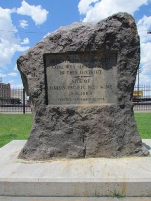
Beneath This Monument

Photographed by Duane Hall, July 6, 2013
1. Beneath This Monument Marker
Coal Was First Mined
In This District
Site Of
Union Pacific No. 1 Mine
A.D. 1868
Erected September 17, 1938
Erected 1938.
Topics. This historical marker and monument is listed in this topic list: Industry & Commerce. A significant historical date for this entry is September 17, 1850.
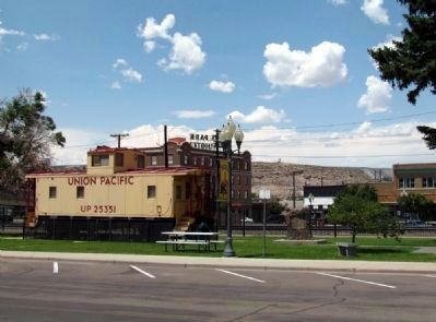
Location. 41° 35.19′ N, 109° 13.248′ W. Marker is in Rock Springs, Wyoming, in Sweetwater County. It is on S. Main Street east of C Street, on the right when traveling west. Marker is located in Railroad Park between the Rock Springs Coal Welcome sign and the railroad depot building. Touch for map. Marker is in this post office area: Rock Springs WY 82901, United States of America. Touch for directions.

Regionally, this marker and monument is in the Westward Expansion Trails Region. It is also in the American Mountain West. Globally, it is in North America, the Rocky Mountains, the Western Hemisphere, the Western World, and the Anglosphere. Historically, it finds itself in what was once Mexico’s Alta California.
Other nearby markers. At least 8 other markers are within 6 miles of this marker, measured as the
this page online
Photographed by Duane Hall, July 6, 2013
2. Beneath This Monument Marker
Photographed by Duane Hall, July 6, 2013
3. Beneath This Monument Marker
Credits. This page was last revised on June 16, 2016. It was originally submitted on August 17, 2013, by Duane Hall of Abilene, Texas. This page has been viewed 766 times since then and 37 times this year. Photos: 1, 2, 3. submitted on August 17, 2013, by Duane Hall of Abilene, Texas.
