Near McGill in White Pine County, Nevada — The American Mountains (Southwest)
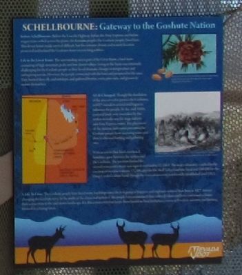
Schellbourne: Gateway to the Goshute Nation
Before Schellbourne: Before the Lincoln Highway, before the Pony Express, and before wagon trains rolled across the plains, the Kusiutta people (the Goshute people) lived here. This desert home has made survival difficult, but the extreme climate and remote location protected and isolated the Goshutes from encroaching settlers.
Life in the Great Basin: The surrounding area is part of the Great Basin, a land mass consisting of high mountain peaks and low desert valleys. Living in the basin was extremely challenging for the Goshute people as they faced dramatic changes in temperature and unforgiving terrain. However, the people connected with the land and prospered in the area. They hunted deer, elk, and antelope, and gathered berries, roots pine nuts, and grasses to sustain themselves.
A Life Changed: Though the desolation of the area served to protect the Goshutes in 1827 outsiders arrived and began to influence the people. By the mid-1800s, essential lands were overtaken by the settlers to make way for stage stations and Pony Express routes. The placement of the stations and routes prevented the Goshute people from accessing water and their traditional hunting and gathering sites. With access to their lands restricted, hostilities grew between the settlers and the Goshutes. The tensions burned for several years until a treaty was signed on October 12, 1863. The treaty ultimately resulted in the creation of two reservations: 17248 acres for the Skull Valley Goshute band and 108,000 for the Deep Creek Goshute band, through the reservations were not formally established until 1912.
A Life to Live: The Goshute people have faced many hardships since the first group of trappers and explorers entered their lives in 1827, forever changing the Goshute story. In the midst of the chaos and upheaval, the people have maintained their cultural values and have continued to foster their connection to the arid desert landscape. It is this connection that keeps them bound to their birthplace, connected to their ancestry, and looking forward to a lasting future.
(Upper Right Image Caption)
The pinyon pine nut was an essential food source for the Goshute people. Pinyon pines grow throughout the desert region.
(Center Right Drawing Caption)
(Illustration by Scott Fisher.)
“Go-Shoot Habitation, Pleasant Valley. Illustration from Captain James H. Simpson’s expedition in 1859. Used by permission, Utah State Historical Society, all rights reserved.
Erected by Nevada Department of Transportation.
Topics. This historical marker is listed in this topic list: Native Americans. A significant historical month for this entry is October 1909.
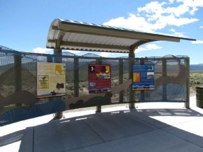
Location. 39° 47.838′ N, 114° 44.462′ W. Marker is near McGill, Nevada, in White Pine County. Marker can be reached from the intersection of U.S. 93 and White Pine County Road 18 (Nevada Route 893), on the right when traveling north. Marker is located at the Schellbourne Rest Area. Touch for map. Marker is in this post office area: Mc Gill NV 89318, United States of America. Touch for directions.
Other nearby markers. At least 8 other markers are within 11 miles of this marker, measured as the crow flies. The Lincoln Highway (here, next to this marker); The Pony Express (here, next to this marker); Schellbourne (here, next to this marker); The Crowds Cheered On ... (a few steps from this marker); Speedy Riders (within shouting distance of this marker); Strength and Endurance (within shouting distance of this marker); Cherry Creek (approx. 10˝ miles away); Cherry Creek School (approx. 10.6 miles away). Touch for a list and map of all markers in McGill.
Credits. This page was last revised on June 16, 2016. It was originally submitted on August 18, 2013, by Duane Hall of Abilene, Texas. This page has been viewed 415 times since then and 23 times this year. Photos: 1, 2. submitted on August 18, 2013, by Duane Hall of Abilene, Texas.
Editor’s want-list for this marker. Clear image of marker with close-ups of graphics and images. • Can you help?

