Creston in San Luis Obispo County, California — The American West (Pacific Coastal)
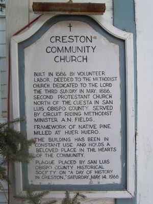
Creston Community Church
Photographed by James King, August 18, 2013
1. Creston Community Church Marker
Framework of native pine milled at Huer Huero.
The building has been in constant use and holds a beloved place in the hearts of the community.
Plaque placed by San Luis Obispo County Historical Society on "A Day of History in Creston," Saturday, May 14, 1966
Erected 1966 by San Luis Obispo County Historical Society.
Topics. This historical marker is listed in this topic list: Religion & Religious Structures. A significant historical month for this entry is May 1886.
Location. 35° 31.133′ N, 120° 31.369′ W. Marker is in Creston, California, in San Luis Obispo County. It is at the intersection of Adams Street and 2nd Street, on the right when traveling north on Adams Street. Coming from Paso Robles or Atascadero (off of Hwy 41), take Webster Road (Hwy 229) into the town of Creston. At the Longbranch Saloon, turn left onto 2nd Street and go one block to Adams. Turn left onto Adams Street and the Church
this page online

Regionally, this marker is on the Central Coast and specifically on the Coast Ranges. It is also on the American Pacific Coast. Globally, it is in North America, on the Ring of Fire, on the Pacific Rim, in the Western Hemisphere, in the Western World, and in the Anglosphere. Historically, it finds itself in what was once New Spain and also Mexico’s Alta California.
Other nearby markers. At least 8 other markers are within 11 miles of this marker, measured as the crow flies: Your American Heritage Monument (approx. 8.3 miles away); Atascadero Administration Building (approx. 8.4 miles away); Sunken Gardens (approx. 8½ miles away); Carlton Hotel (approx. 8½ miles away); Faces of Freedom Veterans Memorial (approx. 9 miles away); Museum Property / Horstman House (approx. 10.4 miles away); Templeton Carriage Works (approx. 10½ miles away); Bethel Lutheran Church (approx. 10½ miles away).
More about this marker. The marker is to the left of the door
Photographed by James King, August 18, 2013
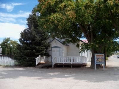
2. Creston Community Church
Photographed by James King, August 18, 2013
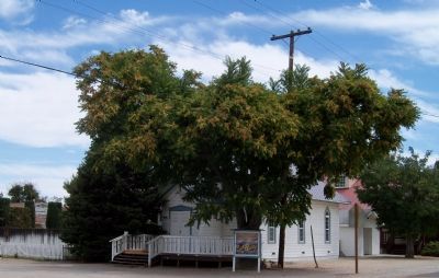
3. Creston Community Church
Photographed by James King, August 18, 2013
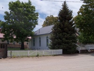
4. Creston Community Church
Credits. This page was last revised on June 16, 2016. It was originally submitted on August 18, 2013, by James King of San Miguel, California. This page has been viewed 720 times since then and 46 times this year. Photos: 1, 2, 3, 4. submitted on August 18, 2013, by James King of San Miguel, California. • Syd Whittle was the editor who published this page.
